Cristoforo Buondelmonti

Cristoforo Buondelmonti (c. 1385 – c. 1430) was an Italian Franciscan priest and traveler, and a pioneer in promoting first-hand knowledge of Greece and its antiquities throughout the Western world.
Biography[]
Cristoforo Buondelmonti was born around 1385 into an important Florentine family. He was taught Greek by Guarino da Verona and received further education from Niccolò Niccoli, an influential Florentine humanist. By 1414 he had become a priest served as a rector of a church in Florence.[1]
He left his native city around 1414 CE in order to travel, mainly in the Aegean Islands. He visited Constantinople in the 1420s. He is the author of two historical-geographic works: the Descriptio insulae Cretae (1417, in collaboration with Niccolò Niccoli) and the Liber insularum Archipelagi (1420). These two books are a combination of geographical information and contemporary charts and sailing directions. The last one contains the oldest surviving map of Constantinople, and the only one which antedates the Ottoman conquest of the city in 1453.
While travelling over the island of Andros, he bought a Greek manuscript and brought back with him to Italy. This was the Hieroglyphica of Horapollo, which played a considerable role both in humanistic thinking and in art.[2]
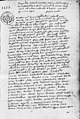
Liber insularum Arcipelagi, 16th-century manuscript. Paris, Bibliothèque Nationale de France, Fonds latin.

See also[]
- The Buondelmonti, a noble family of Florence
References[]
- ^ Gothoni 2003
- ^ Seznec, Jean (1981-01-01). The Survival of the Pagan Gods: The Mythological Tradition and Its Place in Renaissance Humanism and Art. Princeton University Press. ISBN 0691029881.
Sources[]
- Bessi, Benedetta (2013). "Cristoforo Buondelmonti: Greek Antiquities in Florentine Humanism". The Historical Review/La Revue Historique. 9: 63. doi:10.12681/hr.289. ISSN 1791-7603.
- Gothoni, Rene (2003). "Buondelmonti, Cristoforo". In Speake, Jennifer (ed.). Literature of Travel and Exploration: A to F. Fitzroy Dearborn. pp. 140–141. ISBN 9781579584252.
- Harvey, P. D. A. (2007). "Local and Regional Cartography in Medieval Europe". In Woodward, David (ed.). The History of Cartography, Volume 1: Cartography in Prehistoric, Ancient, and Medieval Europe and the Mediterranean, Part 3 (PDF). University of Chicago. pp. 482–484. ISBN 978-0-226-90734-5.
- Thomov, Thomas (1996). "New Information about Cristoforo Buondelmonti's Drawings of Constantinople". Byzantion. 66 (2): 431–453. ISSN 0378-2506.
- G. Gerola, "Le vedute di Costantinopoli di Cristoforo Buondelmonti," SBN 3 (1931): 247–79.
- Cristoforo Buondelmonti, Description of the Aegean and Other Islands at Google Books
| hide Authority control | |
|---|---|
| General |
|
| National libraries | |
| Art research institutes | |
| Other |
|
This biographical article about an Italian writer or poet is a stub. You can help Wikipedia by . |
- 1386 births
- 1430s deaths
- Clergy from Florence
- Italian travel writers
- Italian male non-fiction writers
- Italian geographers
- 15th-century Italian writers
- 15th-century travel writers
- 15th-century geographers
- Medieval travel writers
- Writers from Florence
- Italian writer stubs