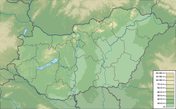
Csém
Csém | |
|---|---|
 Csém Location of Csém | |
| Coordinates: 47°40′52″N 18°05′13″E / 47.6812°N 18.0869°ECoordinates: 47°40′52″N 18°05′13″E / 47.6812°N 18.0869°E | |
| Country | |
| County | Komárom-Esztergom |
| Area | |
| • Total | 6.29 km2 (2.43 sq mi) |
| Population (2004) | |
| • Total | 486 |
| • Density | 77.26/km2 (200.1/sq mi) |
| Time zone | UTC+1 (CET) |
| • Summer (DST) | UTC+2 (CEST) |
| Postal code | 2949 |
| Area code(s) | 34 |
| Motorways | M1 |
| Distance from Budapest | 85.9 km (53.4 mi) East |
Csém is a village in Komárom-Esztergom County, Hungary.
History[]
In the Middle Ages Csém was the property of the Pannonhalma Archabbey until it was destroyed by the Ottomans under Suleiman the Magnificent in 1547. It was not repopulated as a village until the 18th century.[1]
By 1848 Csém had a population of 151.[1]
Notes and references[]
External links[]
Categories:
- Populated places in Komárom-Esztergom County
- Komárom-Esztergom geography stubs

