Csepel
21st District of Budapest
Budapest XXI. kerülete Csepel | |
|---|---|
| District XXI | |
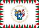 Flag  Coat of arms | |
 Location of District XXI in Budapest (shown in grey) | |
| Coordinates: 47°25′N 19°05′E / 47.417°N 19.083°ECoordinates: 47°25′N 19°05′E / 47.417°N 19.083°E | |
| Country | |
| Region | Central Hungary |
| City | Budapest |
| Established | 1 January 1950 |
| Quarters[1] | show
List |
| Government | |
| • Mayor | Lénárd Borbély (Fidesz-KDNP) |
| Area | |
| • Total | 25.75 km2 (9.94 sq mi) |
| Area rank | 12th |
| Population (2016)[2] | |
| • Total | 76,911 |
| • Rank | 11th |
| • Density | 2,986/km2 (7,730/sq mi) |
| Demonym(s) | huszonegyedik kerületi ("21st districter") |
| Time zone | UTC+1 (CET) |
| • Summer (DST) | UTC+2 (CEST) |
| Postal code | 1211 ... 1215 |
| Website | www |

Csepel (German: Tschepele) is the 21st district and a neighbourhood in Budapest, Hungary. Csepel officially became part of Budapest on 1 January 1950.
Location[]
Csepel is located at the northern end of Csepel Island in the Danube, and covers one-tenth of the island's area. Being on an island, it is the only complete district of Budapest which is neither in Pest nor in Buda. On the western side it is bordered by the Danube, while the Ráckevei-Duna (Ráckeve's Danube) runs along the eastern side. The twenty-first district is bordered by the settlements of Szigetszentmiklós and Lakihegy to the south. It has approximately 85,000 inhabitants.
Transportation[]
Csepel is most easily accessed from central Budapest by the H7 Csepel HÉV, a high capacity suburban railway. In addition, it is served by BKK[3] buses 138, 35, 36, 148, 151, and 179. Bridges connect Csepel to southern parts of Pest, Ferencváros and Pesterzsébet, and a ferry links Csepel to Soroksár.
By car Csepel can be reached by crossing the Kvassay Bridge (Kvassay híd), Gubacsi Bridge (Gubacsi híd), the D-14 ferry, or via the M0 motorway.
A separated bike path is also maintained across the Kvassay and Gubacsi Bridges.
Name[]
The village and the island were named after the first comes (Hungarian: ispán) of the area, Csepel. The German and Serbo-Croat names are derived from the older Hungarian one.
History[]
Csepel Island became the personal domain of Árpád after the migration of Hungarians into Pannonia in the early 10th century. It remained a favourite resort of the Hungarian kings in the Middle Ages. From 1484 onwards Csepel was the wedding present to future Hungarian queens. The Ottoman Turks totally destroyed the village and the royal manor house in the 16th century. At the end of the 17th century, Serb refugees from Turkish-occupied Serbia settled here. At the beginning of the 18th century Prince Eugene of Savoy, owner of the island, re-established the settlement and populated it with German colonists. It became an independent municipality in 1742. The original village was located in the present-day freeport () area but it was totally destroyed by the great flood of 1838. The new village was built on higher ground, in present-day Ófalu (Old Village). The town had a population of 9462 according to the 1910 census (the ethnic composition was 84% Hungarian and 18% German[clarification needed]). Formerly it was a working-class borough with several factories; there was even a bicycle named Csepel. During the Hungarian Revolution of 1956 in Budapest, Hungarian fighters made their last stand in Csepel. Today, Csepel contains housing estates as well as middle-class garden suburbs. The district is home to the sports club Csepel SC.
Population[]
| Year | Pop. | ±% |
|---|---|---|
| 1870 | 1,356 | — |
| 1880 | 1,555 | +14.7% |
| 1890 | 2,277 | +46.4% |
| 1900 | 4,605 | +102.2% |
| 1910 | 9,752 | +111.8% |
| 1920 | 14,075 | +44.3% |
| 1930 | 23,805 | +69.1% |
| 1941 | 47,812 | +100.8% |
| 1949 | 46,621 | −2.5% |
| 1960 | 59,963 | +28.6% |
| 1970 | 73,780 | +23.0% |
| 1980 | 76,692 | +3.9% |
| 1990 | 90,197 | +17.6% |
| 2001 | 80,982 | −10.2% |
| 2008 | 76,320 | −5.8% |
Ethnic groups (2001 census):
- Magyars – 92.4%
- Germans – 0.7%
- Romani – 0.7%
- Others – 0.9%
- No answer – 5.3%
Religions (2001 census):
- Roman Catholic – 41.4%
- Calvinist – 13%
- Greek Catholic – 2.2%
- Lutheran – 1.7%
- Other (Christian) – 1%
- Other (non-Christian) – 0.3%
- Atheists – 25.1%
- No answer, unknown – 15.2%
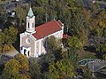
Landmarks[]
Noteworthy sights include the Baroque parish church built in 1770, the Csepel Gallery and Museum of Local History (newly moved to Szent Istvan ut. 230), and the Csepel Collection of Factory History.
List of mayors[]
| Member | Party | Date | |
|---|---|---|---|
| SZDSZ | 1990–1994 | ||
| MSZP | 1994–2010 | ||
| Szilárd Németh | Fidesz | 2010–2014 | |
| Lénárd Borbély | Fidesz | 2014– | |
Gallery[]


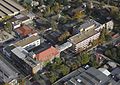

Béke téri Stadion, the home of Csepel FC, and former Nemzeti Bajnokság champion, Csepel SC


See also[]
References[]
- ^ "94/2012. (XII. 27.) Főv. Kgy. rendelet – a közterület- és városrésznevek megállapításáról, azok jelöléséről, valamint a házszám-megállapítás szabályairól" (in Hungarian).
- ^ Jump up to: a b "A fővárosi kerületek, a megyei jogú városok, a városok területe, lakónépessége és a lakások száma" [The area of districts of the capital, of the towns with county's rights, resident population and number of dwellings]. Magyarország közigazgatási helynévkönyve 2016. január 1 [Gazetteer of Hungary 1 January 2016] (PDF). Hungarian Central Statistical Office. 2016. p. 21.
- ^ "BKK Budapesti Közlekedési Központ". BKK Budapesti Közlekedési Központ. Retrieved 14 November 2019.
External links[]
| Wikimedia Commons has media related to Csepel. |
| Wikivoyage has a travel guide for Csepel. |
| show |
|---|

| show Districts of Budapest |
|---|

- Csepel