Culebra National Wildlife Refuge
| Culebra National Wildlife Refuge | |
|---|---|
IUCN category IV (habitat/species management area) | |
 | |
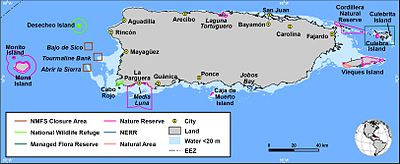
 Location in Puerto Rico | |
| Location | Puerto Rico, Caribbean |
| Nearest city | Culebra, Puerto Rico |
| Coordinates | 18°20′18″N 65°15′29″W / 18.3382888°N 65.2579344°W[1]Coordinates: 18°20′18″N 65°15′29″W / 18.3382888°N 65.2579344°W[1] |
| Area | 5.86 km2 (1,450 acres) |
| Established | 1909 |
| Governing body | U.S. Fish and Wildlife Service |
| Website | Culebra National Wildlife Refuge |

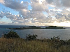
The Culebra National Wildlife Refuge is a National Wildlife Refuge in Puerto Rico. It is part of the Caribbean Islands National Wildlife Refuge Complex, which is a unit of the U.S. Fish and Wildlife Service. It is the site of the former Camp Roosevelt.[2]
Background[]
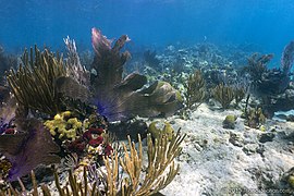
More than 50,000 seabirds of 13 species find their way to this dot in the ocean every year to breed and nurture their young, with the largest sooty tern nesting in the Culebra archipelago being found on Peninsula Flamenco.
Many other bird species permanently call Culebra home while three species of sea turtles, including leatherback and hawksbill, use the waters surrounding Culebra and nest on refuge beaches.
Gallery[]


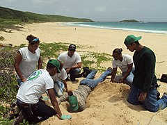
Volunteers relocating sea turtle nests at Culebra NWR.


References[]
- ^ "Culebra National Wildlife Refuge". Geographic Names Information System. United States Geological Survey. Retrieved 2012-12-06.
- ^ "Southeast Archeological Center". NPS Gov.
![]() This article incorporates public domain material from websites or documents of the United States Fish and Wildlife Service.
This article incorporates public domain material from websites or documents of the United States Fish and Wildlife Service.
External links[]
This article related to a protected area in the United States is a stub. You can help Wikipedia by . |
This Culebra, Puerto Rico location article is a stub. You can help Wikipedia by . |
- IUCN Category IV
- Culebra, Puerto Rico
- National Wildlife Refuges in Puerto Rico
- United States protected area stubs
- Puerto Rico Senatorial district VIII geography stubs