Culpeper Basin

The Culpeper Basin is one of the Newark Supergroup's Triassic .[1] It lies east of the Appalachian Mountains and extends from the Madison County—Orange County line in Virginia to Frederick, Maryland.[2] A diverse group of sedimentary rocks including siltstone, sandstone, and congolmerate within the basin were intruded by igneous rocks (primarily diabase), which caused thermal metamorphism at the contact with sedimentary rock.[3]
The Culpeper Basin is nearly continuous with the to the north and with the to the south.
The of the Bull Run Formation is exposed there.[1] The formation has produced disarticulated fish remains including isolated bones and scales.[1]
The large body of diabase in central Montgomery County, Maryland, is known as the Boyds Sill,[4] named after the town of Boyds.

Jurassic diabase boulders in the Culpeper Basin northeast of Dulles Airport

Balls Bluff Siltstone with diabase intrusion, northern face of Luck Stone Quarry, Manassas

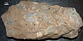
Limestone conglomerate of Leesburg Member
Another sample of limestone conglomerate

Sandstone from southwest the Boyds Sill in Montgomery County, Maryland
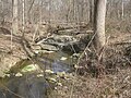
Unnamed stream exposing diabase of Boyds Sill, Hoyles Mill Trail, Montgomery County, Maryland


Footnotes[]
- ^ Jump up to: a b c "Manassas National Battlefield Park," Hunt, Santucci, and Kenworthy (2006); page 64.
- ^ Bedrock map and geotechnical properties of rocks of the Culpeper basin, Virginia and Maryland, Leavy, B.D., Froelich, A.J., and Abram, E.C. Miscellaneous Investigations Series Map I-1313-C. 1983. Map Scale: 1:125,000.
- ^ Geologic history and stratigraphy of the Triassic-Jurassic Culpeper Basin, Virginia, R. C. Lindholm. GSA Bulletin (1979) 90 (11_Part_II): 1702–1736. https://doi.org/10.1130/GSAB-P2-90-1702
- ^ Fisher, G. W., 1964, The Triassic rocks of Montgomery County. In Geology of Howard and Montgomery Counties, Maryland Geological Survey, Baltimore, Maryland, 1964.)
References[]
- Hunt, ReBecca K., Vincent L. Santucci and Jason Kenworthy. 2006. "A preliminary inventory of fossil fish from National Park Service units." in S.G. Lucas, J.A. Spielmann, P.M. Hester, J.P. Kenworthy, and V.L. Santucci (ed.s), Fossils from Federal Lands. New Mexico Museum of Natural History and Science Bulletin 34, pp. 63–69.
| Authority control: National libraries |
|---|
- Geology of Maryland