Cumbria Coastal Way
| Cumbria Coastal Way | |
|---|---|
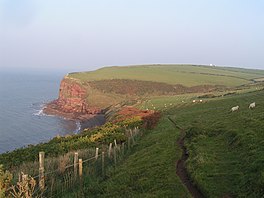 St. Bees Head which lies on the trail | |
| Length | 298 km (185 mi) |
| Location | Northern England, United Kingdom |
| Trailheads | Silverdale, Lancashire Gretna, Dumfries and Galloway |
| Use | Hiking |
| Hiking details | |
| Season | All year |

A sign along the route, near Ulverston
The Cumbria Coastal Way (CCW) is a long-distance footpath in Cumbria in northern England, following the coast from Silverdale, just over the Lancashire border, to just north of the Anglo-Scottish border. It is now part of the England Coast Path.
The path follows some interesting scenery such as the red sandstone cliffs of St. Bees Head. It passes through the following locations (from South to North):
- Silverdale, Lancashire - 54°10′01″N 2°49′37″W / 54.167°N 2.827°W
- Arnside
- Grange-over-Sands
- Greenodd
- Ulverston
- Barrow-in-Furness
- Askam-in-Furness
- Kirkby-in-Furness
- Broughton-in-Furness
- Millom
- Ravenglass
- Seascale
- St. Bees
- St. Bees Head
- Whitehaven
- Workington
- Maryport
- Allonby
- Mawbray
- Beckfoot
- Silloth
- Abbeytown
- Burgh by Sands
- Carlisle - 54°53′42″N 2°56′02″W / 54.895°N 2.934°W

References[]
- Brodie, Ian O.; Brodie, Krysia (1994). The Cumbria Coastal Way. Ellenbank Press. ISBN 1-873551-10-X.
- Brodie, Ian O.; Brodie, Krysia (2007). The Cumbria Coastal Way. Milnthorpe: Cicerone. ISBN 978-1-85284-430-1.
External links[]
| Wikimedia Commons has media related to Cumbria Coastal Way. |
Categories:
- Coastal paths in England
- Footpaths in Cumbria
- Long-distance footpaths in England