Curitibanos
show This article may be expanded with text translated from the corresponding article in Portuguese. (December 2011) Click [show] for important translation instructions. |
Curitibanos | |
|---|---|
 Church in Curitibanos | |
 Flag  Seal | |
| Nickname(s): Ame Curitibanos (Love Curitibanos) | |
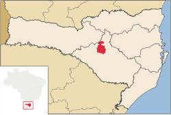 Location of Curitibanos | |
 Curitibanos Location of Curitibanos | |
| Coordinates: 27°18′00″S 50°34′30″W / 27.30000°S 50.57500°WCoordinates: 27°18′00″S 50°34′30″W / 27.30000°S 50.57500°W | |
| Country | |
| Region | South |
| State | |
| Founded | June 11, 1869 |
| Government | |
| • Mayor | Kleberson Luciano Lima[1] (PMDB) |
| Area | |
| • Total | 952.283 km2 (367.679 sq mi) |
| Elevation | 987 m (3,238 ft) |
| Population (2020 [2]) | |
| • Total | 39,893 |
| • Density | 40.0/km2 (104/sq mi) |
| Time zone | UTC-3 (UTC-3) |
| • Summer (DST) | UTC-2 (UTC-2) |
| HDI (2000) | 0.769 |
| Website | www.curitibanos.sc.gov.br |

Curitibanos is a Brazilian municipality in the state of Santa Catarina. It is located at a latitude 27º16'58" south and a longitude 50º35'04" west, being at an altitude of 987 metres. It has an area of 953.67 km² and its population, according to 2018 IBGE estimates, was 39 595 inhabitants.
References[]
External links[]
 Curitibanos travel guide from Wikivoyage
| show Authority control |
|---|
This Santa Catarina, Brazil location article is a stub. You can help Wikipedia by . |
Categories:
- Municipalities in Santa Catarina (state)
- Santa Catarina (state) geography stubs