Cushing Municipal Airport
Cushing Municipal Airport | |||||||||||||||||||||||
|---|---|---|---|---|---|---|---|---|---|---|---|---|---|---|---|---|---|---|---|---|---|---|---|
| Summary | |||||||||||||||||||||||
| Airport type | Public | ||||||||||||||||||||||
| Owner | City of Cushing | ||||||||||||||||||||||
| Serves | Cushing, Oklahoma | ||||||||||||||||||||||
| Elevation AMSL | 925 ft / 282 m | ||||||||||||||||||||||
| Coordinates | 35°57′00″N 096°46′24″W / 35.95000°N 96.77333°WCoordinates: 35°57′00″N 096°46′24″W / 35.95000°N 96.77333°W | ||||||||||||||||||||||
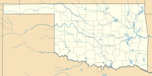
| Map | |||||||||||||||||||||||
 CUH | |||||||||||||||||||||||
| Runways | |||||||||||||||||||||||
| |||||||||||||||||||||||
| Statistics (2011) | |||||||||||||||||||||||
| |||||||||||||||||||||||
Cushing Municipal Airport (IATA: CUH[2], ICAO: KCUH, FAA LID: CUH) is two miles south of Cushing, in Payne County, Oklahoma.[1] The National Plan of Integrated Airport Systems for 2021-2025 categorized it as a general aviation airport.[3]
Facilities[]
The airport covers 672 acres (272 ha) at an elevation of 925 feet (282 m). Runway 18/36 is concrete, 5,201 by 100 feet (1,585 x 30 m); three runways are grass: 2/20 is 2,650 by 60 feet (808 x 18 m), 8/26 is 2,700 by 40 feet (823 x 12 m), and 11/29 is 2,500 by 50 feet (762 x 15 m).[1]
In the year ending September 23, 2011 the airport had 2,500 general aviation aircraft operations, average 208 per month. 16 aircraft were then based at this airport: 88% single-engine, 6% jet, and 6% helicopter.[1]
References[]
- ^ a b c d FAA Airport Form 5010 for CUH PDF. Federal Aviation Administration. Effective May 31, 2012.
- ^ "IATA Airport Code Search (CUH: Cushing Municipal)". International Air Transport Association. Retrieved December 15, 2012.
- ^ "National Plan of Integrated Airport Systems (2021-2025), page A-83" (PDF). FAA. Retrieved December 28, 2020.
External links[]
- Cushing Municipal Airport (AQR) at Oklahoma Aeronautics Commission
- Cushing Flight Service, the fixed-base operator (FBO)
- Aerial image as of February 1995 from USGS The National Map
- FAA Terminal Procedures for CUH, effective February 24, 2022
- Resources for this airport:
- FAA airport information for CUH
- AirNav airport information for KCUH
- ASN accident history for CUH
- FlightAware airport information and live flight tracker
- NOAA/NWS weather observations: current, past three days
- SkyVector aeronautical chart, Terminal Procedures
Categories:
- Airports in Oklahoma
- Buildings and structures in Payne County, Oklahoma
