Dakshinkali
Dakshinkali Municipality
दक्षिणकाली नगरपालिका | |
|---|---|
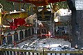
 Dakshinkali in 2009 | |
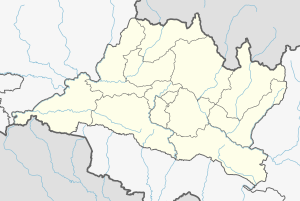 Dakshinkali Municipality Location in Nepal | |
| Coordinates: 27°35′0″N 85°15′0″E / 27.58333°N 85.25000°ECoordinates: 27°35′0″N 85°15′0″E / 27.58333°N 85.25000°E | |
| Country | |
| Region | Central |
| Zone | Bagmati Zone |
| District | Kathmandu District |
| Established | December 2014 |
| Government | |
| • Mayor | Mohan Basnet |
| • Deputy Mayor | Basanti Tamang (Dangol) |
| Area | |
| • Total | 42.6 km2 (16.4 sq mi) |
| Population | |
| • Total | 24,297 |
| • Density | 570/km2 (1,500/sq mi) |
| • Ethnicities | Newar Bahun Chhetri Tamang Magar |
| Time zone | UTC+5:45 (NST) |
| Website | www |


Dakshinkali is a municipality in Kathmandu District in the Province No. 3 of Nepal that was established on 2 December 2014 by merging the former Village development committees Chalnakhel, Chhaimale, Sheshnarayan, Sokhel, Talku Dudechaur and Old-Dakshinkali.[1][2] The municipality's name means 'Southern Kali' and refers to a several centuries old temple complex that lies in the vicinity.
Population[]
Dakshinkali municipality has a total population of 24,297 according to 2011 Nepal census.[3]
- Dakshinkali municipality

Pharping

Fields

Grain harvest
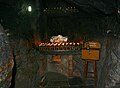
Cave of Goraknath
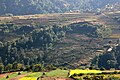
Rice terraces

Prayer flags
Monastery of Vajrayogini
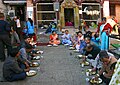
Dakshinkali temple


See also[]
References[]
- ^ "Govt announces 61 municipalities". The Kathmandu Post. 3 December 2014. Retrieved 2 December 2014.[permanent dead link]
- ^ "Govt creates 61 new municipalities". República. 3 Dec 2014. Retrieved 2 Dec 2014.
- ^ "2011 Nepal census (Ward Level)" (PDF). Central Bureau of Statistics. November 2012. Archived from the original (PDF) on July 31, 2013. Retrieved November 2012. Check date values in:
|accessdate=(help)
External links[]
Headquarter: Kathmandu | |||
 | Metropolitan Cities |  | |
| Municipalities |
| ||
| Former VDCs |
| ||
| Wikimedia Commons has media related to Dakshinkali. |
This article about a location in Kathmandu District, Nepal is a stub. You can help Wikipedia by . |
Categories:
- Populated places in Kathmandu District
- Kathmandu District geography stubs