Daugaard-Jensen Land
 View of the cliffs flanking Petermann Fjord marking the eastern limits of Daugaard-Jensen Land. | |
 Daugaard-Jensen Land | |
| Geography | |
|---|---|
| Location | NW Greenland |
| Coordinates | 80°19′N 61°30′W / 80.317°N 61.500°WCoordinates: 80°19′N 61°30′W / 80.317°N 61.500°W |
| Adjacent bodies of water | |
| Length | 120 km (75 mi) |
| Width | 90 km (56 mi) |
| Highest elevation | 1,066 m (3497 ft) |
| Administration | |
Greenland (Denmark) | |
| Demographics | |
| Population | Uninhabited |

Daugaard-Jensen Land, (Danish: Daugård-Jensen Land), is a peninsula in northwestern Greenland. It is a part of the Avannaata municipality.[1]
Daugaard-Jensen Land was named in honour of (1871–1938), who was Inspector of Greenland between 1900 and 1912.
Geography[]
Daugaard-Jensen Land is located between Washington Land and the Petermann Glacier. The Cass Fjord is at the southern end, beyond which lies the Humboldt Glacier.[2] The Pentamerus Range is located in the middle/northern region.[1]
The northern coast runs between and Bessel Fjord, east of which the extends northwards.[3]
 Map of part of Ellesmere Island and far Northern Greenland. |
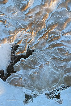 Daugaard-Jensen Land NASA picture. |
Bibliography[]
- H.P. Trettin (ed.), Geology of the Innuitian Orogen and Arctic Platform of Canada and Greenland. Geological Survey of Canada (1991) ISBN 978-0660131313
See also[]
References[]
- ^ a b "Daugård-Jensen Land". Mapcarta. Retrieved 6 March 2019.
- ^ GoogleEarth
- ^ Prostar Sailing Directions 2005 Greenland and Iceland Enroute, p. 93
External links[]
This Greenland location article is a stub. You can help Wikipedia by . |
Categories:
- Peninsulas of Greenland
- Greenland geography stubs