Dean Island (Antarctica)
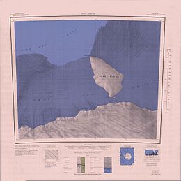 1:250,000 scale topographic map of Dean Island. | |
 Dean Island Location in Antarctica | |
| Geography | |
|---|---|
| Location | Antarctica |
| Coordinates | 74°30′S 127°35′W / 74.500°S 127.583°WCoordinates: 74°30′S 127°35′W / 74.500°S 127.583°W |
| Area | 702 km2 (271 sq mi) |
| Length | 37 km (23 mi) |
| Width | 19 km (11.8 mi) |
| Administration | |
| Administered under the Antarctic Treaty System | |
| Demographics | |
| Population | Uninhabited |

Dean Island in the Antarctic is an ice-covered island, 37 kilometres (20 nmi) long and 19 kilometres (10 nmi) wide, lying within the Getz Ice Shelf and midway between Grant Island and Siple Island, off the coast of Marie Byrd Land. It was first sighted from a distance of 37 kilometres (20 nmi) from the USS Glacier on February 5, 1962, and was named for Chief Warrant Officer , U.S. Navy, Electrical Officer on the Glacier at the time of discovery.
See also[]
References[]
 This article incorporates public domain material from the United States Geological Survey document: "Dean Island (Antarctica)". (content from the Geographic Names Information System)
This Marie Byrd Land location article is a stub. You can help Wikipedia by . |
Categories:
- Islands of Marie Byrd Land
- Marie Byrd Land geography stubs