Delta Municipal Airport
Delta Municipal Airport | |||||||||||
|---|---|---|---|---|---|---|---|---|---|---|---|
| Summary | |||||||||||
| Airport type | Public | ||||||||||
| Owner | Delta City Corporation | ||||||||||
| Serves | Delta, Utah | ||||||||||
| Elevation AMSL | 4,759 ft / 1,451 m | ||||||||||
| Coordinates | 39°22′50″N 112°30′28″W / 39.38056°N 112.50778°WCoordinates: 39°22′50″N 112°30′28″W / 39.38056°N 112.50778°W | ||||||||||
| Map | |||||||||||
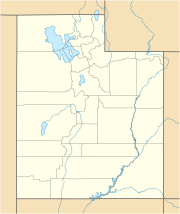 DTA | |||||||||||
| Runways | |||||||||||
| |||||||||||
| Statistics (2010) | |||||||||||
| |||||||||||

Delta Municipal Airport (IATA: DTA, ICAO: KDTA, FAA LID: DTA) is three miles (6 km) northeast of Delta, in Millard County, Utah.[1] The National Plan of Integrated Airport Systems for 2011–2015 categorized it as a general aviation airport.[2]
The airport opened in June 1943.[3] The airport's runways were last resurfaced around 1989, and due to a lack of funding were risking shutdown by 1999, but as of 2009 the airport is open.[4]
Facilities[]
Delta Municipal Airport covers 896 acres (363 ha) at an elevation of 4,759 feet (1,451 m). Its single runway, 17/35, is 5,500 by 75 feet (1,676 x 23 m).[1]
In 2010 the airport had 2,156 aircraft operations, average 179 per month: 98% general aviation and 2% air taxi. Ten aircraft were then based at this airport, all single-engine.[1]
References[]
- ^ a b c d FAA Airport Form 5010 for DTA PDF. Federal Aviation Administration. Effective April 5, 2012.
- ^ "2011–2015 NPIAS Report, Appendix A" (PDF). National Plan of Integrated Airport Systems. Federal Aviation Administration. October 4, 2010. Archived from the original (PDF, 2.03 MB) on 2012-09-27.
- ^ Madsen, Reed L. (July 19, 1999). "Lack of funds may doom Fillmore, Delta airports Closure at both could come in next few years". Deseret News. Retrieved September 7, 2009.
External links[]
| Wikimedia Commons has media related to Delta Municipal Airport. |
- Aerial image as of June 1993 from USGS The National Map
- FAA Terminal Procedures for DTA, effective February 24, 2022
- Resources for this airport:
- FAA airport information for DTA
- AirNav airport information for KDTA
- ASN accident history for DTA
- FlightAware airport information and live flight tracker
- SkyVector aeronautical chart for KDTA
- Airports in Utah
- Buildings and structures in Millard County, Utah
- Transportation in Millard County, Utah