Den Bommel
Den Bommel | |
|---|---|
Village | |
 | |
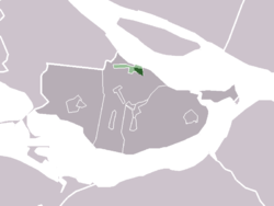 The village centre (darkgreen) and the statistical district (lightgreen) of Den Bommel in the former municipality of Oostflakkee. | |
| Coordinates: 51°42′55″N 4°16′43″E / 51.7152420°N 4.2787465°ECoordinates: 51°42′55″N 4°16′43″E / 51.7152420°N 4.2787465°E | |
| Country | Netherlands |
| Province | South Holland |
| Municipality | Goeree-Overflakkee |
| Population (January 2006) | 1,729 |


Den Bommel, reformed church
Den Bommel is a village in the Dutch province of South Holland. It is a part of the municipality of Goeree-Overflakkee, and lies about 14 km south of Spijkenisse.
In 2001, the village of Den Bommel had 1,214 inhabitants. The built-up area of the village was 0.24 km², and contained 491 residences.[1] The slightly larger statistical district "Den Bommel" has a population of around 1,390.[2]
References[]
- ^ Statistics Netherlands (CBS), Bevolkingskernen in Nederland 2001 "Archived copy". Archived from the original on 2006-03-19. Retrieved 2007-01-24.CS1 maint: archived copy as title (link). Statistics are for the continuous built-up area.
- ^ Statistics Netherlands (CBS), Gemeente Op Maat 2004: Oostflakkee [1][permanent dead link].
| Authority control: National libraries |
|---|
This South Holland location article is a stub. You can help Wikipedia by . |
Categories:
- Former municipalities of South Holland
- Populated places in South Holland
- Goeree-Overflakkee
- South Holland geography stubs