Derrybrien
Derrybrien
Daraidh Braoin | |
|---|---|
Village | |
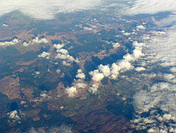 Derrybrien Village and Wind Farm | |
 Derrybrien Location in Ireland | |
| Coordinates: 53°03′57″N 8°36′38″W / 53.0659°N 8.6105°WCoordinates: 53°03′57″N 8°36′38″W / 53.0659°N 8.6105°W | |
| Country | Ireland |
| Province | Connacht |
| County | Galway |
| Irish Grid Reference | M590018 |

Derrybrien (Irish: Daraidh Braoin) is a tiny village in County Galway, Ireland. It lies along the R353 road in the Slieve Aughty Mountains. The village church is dedicated to Saint Patrick and is part of the Roman Catholic Parish of Ballinakill and Derrybrien.[1]
The Derrybrien Necklace, an amber beaded necklace dated to the Bronze Age was discovered near Derrybrien in June 1954 by Joseph McHugo.[citation needed]
A 60MW wind farm with 70 turbines is located on a hill nearby.[2] The 2003 Derrybrien landslide resulted in the prosection and conviction of the engineering and construction companies involved in the wind farm's development.[3]
See also[]
- List of towns and villages in Ireland
References[]
- ^ Parish of Ballinakill and Derrybrien. Retrieved on 14 January 2009.
- ^ "ESB International" (PDF). www.esbi.ie. Retrieved 22 June 2017.
- ^ "Companies convicted for Galway river pollution". rte.ie. RTÉ News. 20 October 2004. Retrieved 9 July 2020.

This article related to the geography of County Galway, Ireland is a stub. You can help Wikipedia by . |
- Towns and villages in County Galway
- County Galway geography stubs