Devil's Water
| Devil's Water | |
|---|---|
 Devil's Water | |
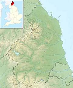 Location within Northumberland | |
| Location | |
| Country | United Kingdom |
| County | Northumberland |
| Physical characteristics | |
| Mouth | |
• coordinates | 54°58′29″N 2°02′22″W / 54.9746°N 2.0395°WCoordinates: 54°58′29″N 2°02′22″W / 54.9746°N 2.0395°W |
| Length | 26.3 km (16.3 mi) |

Devil's Water is a river in Northumberland, England. A tributary of the River Tyne, it joins that river from the south, near the village of about 1 mile (1.6 km) south-west of Corbridge. It is formed from the waters of several smaller burns and sikes between and some 5 miles (8 km) south of Hexham.[1][2][3]
Its tributaries include the Rowley Burn and West Dipton Burn.[2]
Devil's Water is of historical interest, figuring in the Battle of Hexham.
Etymology[]
The name Devil's Water may share an etymology with the various rivers named Douglas in Northern England and Scotland such as the Douglas Water and River Douglas.[4] The name is derived from the Brittonic elements dūβ-, meaning "black",[4] and *glẹ:ss, "stream, rivulet, watercourse" (Welsh du-glais).[4]
References[]
- ^ "Devil's Water". The UK Rivers Guidebook. 2000-01-01. Retrieved 14 April 2016.
- ^ a b "Devils Water from Rowley Burn to Tyne". Catchment Data Explorer. Environment Agency. Retrieved 14 April 2016.
- ^ "Devils Water from Source to Rowley Burn". Catchment Data Explorer. Environment Agency. Retrieved 14 April 2016.
- ^ a b c James, Alan. "A Guide to the Place-Name Evidence" (PDF). SPNS - The Brittonic Language in the Old North. Archived from the original (PDF) on 13 August 2017. Retrieved 25 November 2018.
This Northumberland location article is a stub. You can help Wikipedia by . |
- Rivers of Northumberland
- History of Northumberland
- Tyne catchment
- Northumberland geography stubs
- England river stubs