Devils Island (Nova Scotia)
This article includes a list of references, related reading or external links, but its sources remain unclear because it lacks inline citations. (November 2012) |
Devils Island | |
|---|---|
Island community | |
 Lighthouse on Devils Island | |
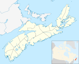 Devils Island Location of Devils Island, Nova Scotia | |
| Coordinates: 44°35′0″N 63°27′32.59″W / 44.58333°N 63.4590528°WCoordinates: 44°35′0″N 63°27′32.59″W / 44.58333°N 63.4590528°W | |
| Country | Canada |
| Province | Nova Scotia |
| Municipality | Halifax Regional Municipality |
| District | 9 |
| Founded | 1711 |
| Area (Island) | |
| • Total | .12 km2 (0.04633224 sq mi) |
| Elevation | 4.6 m (15.1 ft) |
| Time zone | UTC-4 (AST) |
| • Summer (DST) | UTC-3 (ADT) |
| GNBC Code | CAJKW |
| Website | http://www.devilsisland.ca/ |

Devils Island, Nova Scotia is located on the northeast entrance of Halifax Harbour part of the Halifax Regional Municipality off the coast of the community of Eastern Passage, Nova Scotia. The name originated from an early French merchant and was first spelled Deville's Island. The first permanent settlement on this 12 hectare island was established in 1830, and by 1850 there were three houses and a school. By 1901 the settlement had grown to 18 houses. A number of Devil's Island residents, notably Ben Henneberry, provided valuable folklore to pioneering Canadian folklorist Helen Creighton. Most of the residents were moved to the mainland during World War II. The last permanent resident, a Norwegian artist, moved off in 2000. The island is currently owned by Halifax entrepreneur Bill Mont. The Devil's Island Lighthouse built in 1877, replacing an earlier tower built in 1852, is still standing but is not functional and is threatened. The island was also the base for a rescue lifeboat until the 1950s which saved the crews of many vessels stranded on the shoals approaching Halifax Harbour.
References[]
| Wikimedia Commons has media related to Devils Island (Nova Scotia). |
- Islands of Nova Scotia
- Maritime history of Canada
- Landforms of Halifax, Nova Scotia
- General Service Areas in Nova Scotia
- Landforms of Halifax County, Nova Scotia