Donggang River (Taiwan)
| Donggang River | |
|---|---|
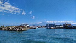 | |
 Donggang River in Taiwan | |
| Location | |
| Country | Taiwan |
| Physical characteristics | |
| Mouth | |
• location | South China Sea: Donggang, Pingtung |
• coordinates | 22°28′05″N 120°26′13″E / 22.468°N 120.437°ECoordinates: 22°28′05″N 120°26′13″E / 22.468°N 120.437°E |
| Length | 44 km (27 mi) |
| Basin size | 472 km2 (182 sq mi) |

The Donggang River (Chinese: 東港溪; pinyin: Dōnggǎng Xī; Wade–Giles: Tung1-kang3 Hsi1; Pe̍h-ōe-jī: Tang-káng-khoe) is a river in Taiwan. It flows through Pingtung County for 44 km.[1][2]
Bridges[]
See also[]
- List of rivers in Taiwan
References[]
- ^ "Geography & demographics". The Republic of China Yearbook 2015. Executive Yuan. 2015. pp. 40–53. ISBN 978-986-04-6013-1.
- ^ "GeoNames Search". Geographic Names Database. National Geospatial-Intelligence Agency, USA. Retrieved 1 May 2016.
This article related to a river in Taiwan is a stub. You can help Wikipedia by . |
Categories:
- Rivers of Taiwan
- Landforms of Pingtung County
- Taiwan river stubs