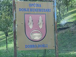
Donji Kukuruzari
Donji Kukuruzari
| |
|---|---|
| Općina Donji Kukuruzari Municipality of Donji Kukuruzari | |
 | |
 Coat of arms | |
 Donji Kukuruzari Location of Donji Kukuruzari in Croatia | |
| Coordinates: 45°15′53″N 16°29′02″E / 45.264602°N 16.483845°E | |
| Country | |
| Region | Continental Croatia (Banovina) |
| County | |
| Area | |
| • Total | 113.78 km2 (43.93 sq mi) |
Donji Kukuruzari (Serbian Cyrillic: Доњи Кукурузари[1]) is a village and a municipality in Croatia in the Sisak-Moslavina County. Donji Kukuruzari is underdeveloped municipality which is statistically classified as the First Category Area of Special State Concern by the Government of Croatia.[3]
It has a population of 1,634 (census 2011), in the following settlements:[4]
- , population 127
- Borojevići, population 119
- , population 261
- , population 43
- Donji Kukuruzari, population 297
- , population 73
- , population 53
- , population 51
- Knezovljani, population 81
- Komogovina, population 126
- , population 43
- , population 19
- Mečenčani, population 148
- , population 120
- Umetić, population 73
Demographics[]
- 1991 Serbs were majority 249 (82.72%), then Croats 43 (14.28%), Yugoslavs 2 (0.66%) and others 7 (2.32%).[5]
- 2011 census, 64.44% (1053) were Croats and 34.82% (569) were Serbs.[6]
Religion[]
Serbian Orthodox Church of the Dormition of the Theotokos[]
Serbian Orthodox Church of the Dormition of the Theotokos in Donji Kukuruzari was completed in 1838 while its iconostasis was painted in 1871 by painter Mihail Kutlija from Jasenovac.[7] The church was devastated by the Ustashe regime during the World War II Genocide of Serbs in the Independent State of Croatia.[7] The church's ring-bell was reconstructed just before the beginning of the Croatian War of Independence and it contained some of the icons originating from the nearby prominent Komogovina School of Orthodox art.[7]
References[]
- ^ Jump up to: a b Government of Croatia (October 2013). "Peto izvješće Republike Hrvatske o primjeni Europske povelje o regionalnim ili manjinskim jezicima" (PDF) (in Croatian). Council of Europe. p. 36. Retrieved 30 November 2016.
- ^ "Općine na područjima posebne državne skrbi Republike Hrvatske" (PDF). Croatian Chamber of Economy. Retrieved 15 April 2020.
- ^ Lovrinčević, Željko; Davor, Mikulić; Budak, Jelena (June 2004). "AREAS OF SPECIAL STATE CONCERN IN CROATIA- REGIONAL DEVELOPMENT DIFFERENCES AND THE DEMOGRAPHIC AND EDUCATIONAL CHARACTERISTICS". Ekonomski pregled, Vol.55 No.5-6. Archived from the original on 18 August 2018. Retrieved 25 August 2018.
- ^ "Population by Age and Sex, by Settlements, 2011 Census: Donji Kukuruzari". Census of Population, Households and Dwellings 2011. Zagreb: Croatian Bureau of Statistics. December 2012.
- ^ Izdanje Državnog zavoda za statistiku RH: Narodnosni sastav stanovništva RH od 1880-1991. godine.
- ^ "Population by Ethnicity, by Towns/Municipalities, 2011 Census: County of Sisak-Moslavina". Census of Population, Households and Dwellings 2011. Zagreb: Croatian Bureau of Statistics. December 2012.
- ^ Jump up to: a b c Škiljan, Filip (2008). Kulturno – historijski spomenici Banije s pregledom povijesti Banije od prapovijesti do 1881 [Cultural and historical monuments of Banija with an overview of history Banija from prehistory to 1881.] (in Serbian). Zagreb, Croatia: Serb National Council. ISBN 978-953-7442-04-0.
- Populated places in Sisak-Moslavina County
- Serb communities in Croatia
- Municipalities of Croatia
- Sisak-Moslavina County geography stubs

