Douy, Eure-et-Loir
Douy | |
|---|---|
Part of Cloyes-les-Trois-Rivières | |
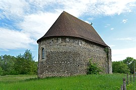 Priory of Saint Julien | |
 Coat of arms | |
show Location of Douy | |
 Douy | |
| Coordinates: 48°02′12″N 1°16′16″E / 48.0367°N 1.2711°ECoordinates: 48°02′12″N 1°16′16″E / 48.0367°N 1.2711°E | |
| Country | France |
| Region | Centre-Val de Loire |
| Department | Eure-et-Loir |
| Arrondissement | Châteaudun |
| Canton | Brou |
| Commune | Cloyes-les-Trois-Rivières |
| Area 1 | 6.84 km2 (2.64 sq mi) |
| Population (2017)[1] | 564 |
| • Density | 82/km2 (210/sq mi) |
| Time zone | UTC+01:00 (CET) |
| • Summer (DST) | UTC+02:00 (CEST) |
| Postal code | 28220 |
| Elevation | 97–146 m (318–479 ft) (avg. 120 m or 390 ft) |
| 1 French Land Register data, which excludes lakes, ponds, glaciers > 1 km2 (0.386 sq mi or 247 acres) and river estuaries. | |


Douy (French pronunciation: [dwi]) was a commune in the Eure-et-Loir department in northern France. On 1 January 2017, it was merged into the new commune Cloyes-les-Trois-Rivières.[2]
Population[]
| Year | Pop. | ±% |
|---|---|---|
| 1962 | 352 | — |
| 1968 | 300 | −14.8% |
| 1975 | 314 | +4.7% |
| 1982 | 359 | +14.3% |
| 1990 | 436 | +21.4% |
| 1999 | 447 | +2.5% |
| 2008 | 502 | +12.3% |
See also[]
- Communes of the Eure-et-Loir department
References[]
- ^ Téléchargement du fichier d'ensemble des populations légales en 2017, INSEE
- ^ Arrêté préfectoral 25 May 2016 (in French)
| Wikimedia Commons has media related to Douy. |
This Eure-et-Loir geographical article is a stub. You can help Wikipedia by . |
Categories:
- Former communes of Eure-et-Loir
- Eure-et-Loir geography stubs