Dowa District
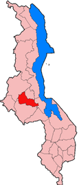
Dowa is a district in the Central Region of Malawi. The capital is Dowa.
Geography[]
The district covers an area of 3,041 km². and has a population of 556, 678. The capital city, Dowa is home to 5,565 people. Dowa the city is about 38 kilometers away from Malawi's capital city, Lilongwe.[1] The population is projected to reach over 700,000 by 2018.[2]
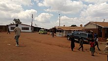
Main cities[]
(MVERA roadblock)
Culture[]
The Chewas are the main ethnic group, and second are the Ngonis. Nyau dancing is an integral part of the culture inherited from the Chewa ancestors. These two groups are mostly farming communities. People of the Yao ethnic group are also found, mostly in trading centers.[3]
Economy[]
Dowa District is an agricultural district which focuses on cotton, tobacco and groundnut farming, and the main food crops produced in the district are maize, sweet potatoes and pulses.[4]
Education[]
Dowa TTC College opened in 2003.[5] The district aims to drop the high school dropout rate from six percent to four percent by 2020, and also add more classrooms to lower the current 111 to 1 student/classroom ratio.[6]
Government and administrative divisions[]
There are seven National Assembly constituencies in Dowa:
- Dowa - Central
- Dowa - East
- Dowa - Ngala
- Dowa - North
- Dowa - North West
- Dowa - South East
- Dowa - West
Since the 2009 election all of the areas have been controlled by members of the Malawi Congress Party.[7]
Climate[]
Dowa District is in the humid subtropical climate zone, and the mean temperature is about 65 degrees Fahrenheit. There are as many as twenty rainy days a month in the wet season to as little as none in the dry season.[8]
References[]
- ^ AM. "Dowa District in Central Region in Malawi - Information on Dowa District - Malawi.Places-in-the-world.com". malawi.places-in-the-world.com. Retrieved 2016-11-17.
- ^ "Against Malaria". The Against Malaria Foundation. Retrieved 2016-11-17.
- ^ "Pure - Login". pure.aber.ac.uk. Retrieved 2020-05-28.
- ^ "Chindura, Dowa District, Central Region, Malawi". www.mindat.org. Retrieved 2020-05-27.
- ^ "Our History". www.dapp-malawi.org. Retrieved 2016-11-17.
- ^ Mambucha, Tiyanjane (2015-06-01). "Malawi: Dowa Council to Address Girls Dropout in Schools". Malawi News Agency (Lilongwe). Retrieved 2016-11-17.
- ^ "Parliament of Malawi - Members of Parliament - Dowa District". Archived from the original on 2016-06-02. Retrieved 2016-05-03.
- ^ "What is the Weather in Dowa District, Dowa, Malawi (first-order administrative division) Forecasts, Weather History, Natural Risks and Hazards - Chinci". www.chinci.com. Archived from the original on 2016-11-17. Retrieved 2016-11-17.
Coordinates: 13°35′S 34°00′E / 13.583°S 34.000°E

| Authority control |
|
|---|
This Malawi location article is a stub. You can help Wikipedia by . |
- Districts of Malawi
- Districts in Central Region, Malawi
- Malawi geography stubs