Driebruggen
Driebruggen | |
|---|---|
Village | |
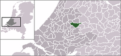 | |
 The village centre (dark green) and the statistical district (light green) of Driebruggen in the municipality of Reeuwijk. | |
| Coordinates: 52°2′36″N 4°47′55″E / 52.04333°N 4.79861°ECoordinates: 52°2′36″N 4°47′55″E / 52.04333°N 4.79861°E | |
| Country | Netherlands |
| Province | South Holland |
| Municipality | Bodegraven-Reeuwijk |
| Population (2008) | |
| • Total | 1,756 |
| Time zone | UTC+1 (CET) |
| • Summer (DST) | UTC+2 (CEST) |

Driebruggen is a village in the Dutch province of South Holland. It is a part of the former municipality of Reeuwijk, and lies about 6 km east of Gouda.
In 2001, the village of Driebruggen had 1313 inhabitants. The built-up area of the village was 0.23 km², and contained 455 residences.[1] The statistical area "Driebruggen", which also includes the surrounding countryside, has a population of around 1410.[2]
Driebruggen was a separate municipality between 1964 and 1989. The name from this village means 3 bridges. It was created in a merger of Hekendorp, Lange Ruige Weide, Papekop, and Waarder.[3]

References[]
- ^ Statistics Netherlands (CBS), Bevolkingskernen in Nederland 2001. (Statistics are for the continuous built-up area).
- ^ Statistics Netherlands (CBS), Statline: Kerncijfers wijken en buurten 2003-2005 Archived 2006-07-24 at WebCite. As of 1 January 2005.
- ^ Ad van der Meer and Onno Boonstra, "Repertorium van Nederlandse gemeenten", KNAW, 2006. "Archived copy". Archived from the original on 2007-02-20. Retrieved 2009-12-03.CS1 maint: archived copy as title (link)
This South Holland location article is a stub. You can help Wikipedia by . |
Categories:
- Bodegraven-Reeuwijk
- Populated places in South Holland
- Former municipalities of South Holland
- South Holland geography stubs