Drobin
Drobin | |
|---|---|
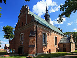 Our Lady of the Rosary and Saint Stanislaus church in Drobin | |
 Coat of arms | |
 Drobin | |
| Coordinates: 52°44′27″N 19°59′21″E / 52.74083°N 19.98917°ECoordinates: 52°44′27″N 19°59′21″E / 52.74083°N 19.98917°E | |
| Country | |
| Voivodeship | Masovian |
| County | Płock |
| Gmina | Drobin |
| First mentioned | 12th century |
| Town rights | 1511 |
| Government | |
| • Mayor | Krzysztof Wielec (PSL) |
| Area | |
| • Total | 9.64 km2 (3.72 sq mi) |
| Population (2006) | |
| • Total | 2,980 |
| • Density | 310/km2 (800/sq mi) |
| Time zone | UTC+1 (CET) |
| • Summer (DST) | UTC+2 (CEST) |
| Postal code | 09-210 |
| Area code(s) | +48 24 |
| Car plates | WPL |
| Website | http://www.drobin.pl |


Drobin [ˈdrɔbʲin] is a town in Płock County, Masovian Voivodeship, Poland, with 3,016 inhabitants (2004).
History[]
The settlement was first mentioned in the 12th century, when it was part of Piast-ruled Poland. It was granted town rights in 1511 under the Jagiellonian dynasty. It was a private town of Polish nobility, administratively located in the Płock Voivodeship in the Greater Poland Province of the Polish Crown.
A battle was fought nearby on August 15, 1920, during the Polish-Soviet War.[1]
During the German occupation of Poland (World War II), the Germans renamed the town Reichenfeld to erase traces of Polish origin, and operated a forced labour camp there.[2]
Sports[]
The local football team is Skra Drobin.[3] It competes in the lower leagues.
References[]
- ^ Kowalski, Andrzej (1995). "Miejsca pamięci związane z Bitwą Warszawską 1920 r.". Niepodległość i Pamięć (in Polish). Muzeum Niepodległości w Warszawie (2/2 (3)): 129. ISSN 1427-1443.
- ^ "Arbeitserziehungslager Reichenfeld". Bundesarchiv.de (in German). Retrieved 2 April 2021.
- ^ "skradrobin.eu" (in Polish). Retrieved 2 April 2021.
External links[]
- Jewish Community in Drobin on Virtual Shtetl

| Authority control |
|
|---|
This Masovian Voivodeship location article is a stub. You can help Wikipedia by . |
- Cities and towns in Masovian Voivodeship
- Płock County
- Płock Governorate
- Warsaw Voivodeship (1919–1939)
- Masovian geography stubs