Drumohar Peak
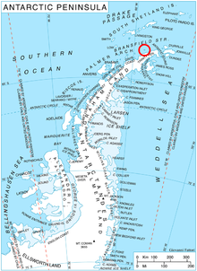
Location of Astrolabe Island in the Antarctic Peninsula region.

Astrolabe Island from northwest, Drumohar Peak is the left one of the two prominent mountains dominating the island.
Drumohar Peak (Bulgarian: връх Друмохар, romanized: vrah Drumohar, IPA: [ˈvrɤɣ dromoˈxar]) is the ice-covered peak rising to 437 m[1] in the northeastern part of Astrolabe Island off Trinity Peninsula, Antarctica.
The peak is named after the settlement of Drumohar in Western Bulgaria.
Location[]
Drumohar Peak is located at 63°18′26″S 58°40′55″W / 63.30722°S 58.68194°WCoordinates: 63°18′26″S 58°40′55″W / 63.30722°S 58.68194°W, which is 3.15 km east of Raduil Point and 1.9 km north-northwest of Rogach Peak. German-British mapping in 1996.
Maps[]
- Trinity Peninsula. Scale 1:250000 topographic map No. 5697. Institut für Angewandte Geodäsie and British Antarctic Survey, 1996.
- Antarctic Digital Database (ADD). Scale 1:250000 topographic map of Antarctica. Scientific Committee on Antarctic Research (SCAR). Since 1993, regularly upgraded and updated.
Notes[]
- ^ Reference Elevation Model of Antarctica. Polar Geospatial Center. University of Minnesota, 2019
References[]
- Drumohar Peak. SCAR Composite Antarctic Gazetteer.
- Bulgarian Antarctic Gazetteer. Antarctic Place-names Commission. (details in Bulgarian, basic data in English)
External links[]
- Drumohar Peak. Copernix satellite image
This article includes information from the Antarctic Place-names Commission of Bulgaria which is used with permission.
This Trinity Peninsula, Antarctica, location article is a stub. You can help Wikipedia by . |
Categories:
- Mountains of Trinity Peninsula
- Bulgaria and the Antarctic
- Astrolabe Island
- Trinity Peninsula geography stubs