Dune Park station
This article needs additional citations for verification. (January 2021) |
Dune Park | |||||||||||||
|---|---|---|---|---|---|---|---|---|---|---|---|---|---|
 Dune Park Station | |||||||||||||
| Location | 33 East U.S. Highway 12 Chesterton, Indiana | ||||||||||||
| Coordinates | 41°38′41″N 87°3′39″W / 41.64472°N 87.06083°W | ||||||||||||
| Owned by | NICTD | ||||||||||||
| Platforms | 1 side platform | ||||||||||||
| Tracks | 2 | ||||||||||||
| Connections | V-Line | ||||||||||||
| Construction | |||||||||||||
| Parking | Yes; free for passengers | ||||||||||||
| Bicycle facilities | Yes; bike rack | ||||||||||||
| Disabled access | Yes | ||||||||||||
| Other information | |||||||||||||
| Fare zone | 6 | ||||||||||||
| History | |||||||||||||
| Opened | 1985 | ||||||||||||
| Electrified | Yes (1500 V DC) | ||||||||||||
| Passengers | |||||||||||||
| 2015 | 520 (average weekday) [1] | ||||||||||||
| Services | |||||||||||||
| |||||||||||||

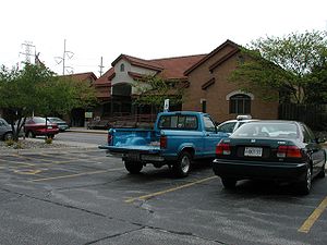
Dune Park is a station in Westchester Township, Porter County, Indiana, located north of the municipalities of Chesterton and Porter. It is used by South Shore Line trains, and serves as the headquarters of the Northern Indiana Commuter Transportation District (NICTD), the umbrella agency that operates the South Shore Line. It is located at the intersection of U.S. Highway 12 and Indiana State Road 49.
Usage[]
Dune Park is a comparatively new station, built in 1985 to serve as a regional commuter station and as NICTD's corporate headquarters.[2] The station was designed to replace the South Shore's former nearby station at Tremont, Indiana, a location that was becoming depopulated with the expansion of the nearby Indiana Dunes National Lakeshore (now Indiana Dunes National Park).
The Dune Park station was built with substantial parking space to consolidate local commuter service, and in 1994 the South Shore Line ceased to offer its traditional flag stop service to Dune Acres and Kemil Road, several miles west and east of Dune Park respectively. Users of these low-volume stops were instructed to instead use the consolidated Dune Park station.
"Dune Park" is so called because it the station is physically surrounded by land owned by the Indiana Dunes National Park. Major units of the National Park are accessible from the station on U.S. 12 and the Calumet Trail. The station is also adjacent to the Indiana Dunes State Park, which is accessible to the north via Indiana 49.
Dune Park was also the name of a former section of the Indiana Dunes, between Ogden Dunes, Indiana and Dune Acres, that was physically leveled in the 1960s to create the Port of Indiana steelmaking and industrial complex.
Planned improvements[]
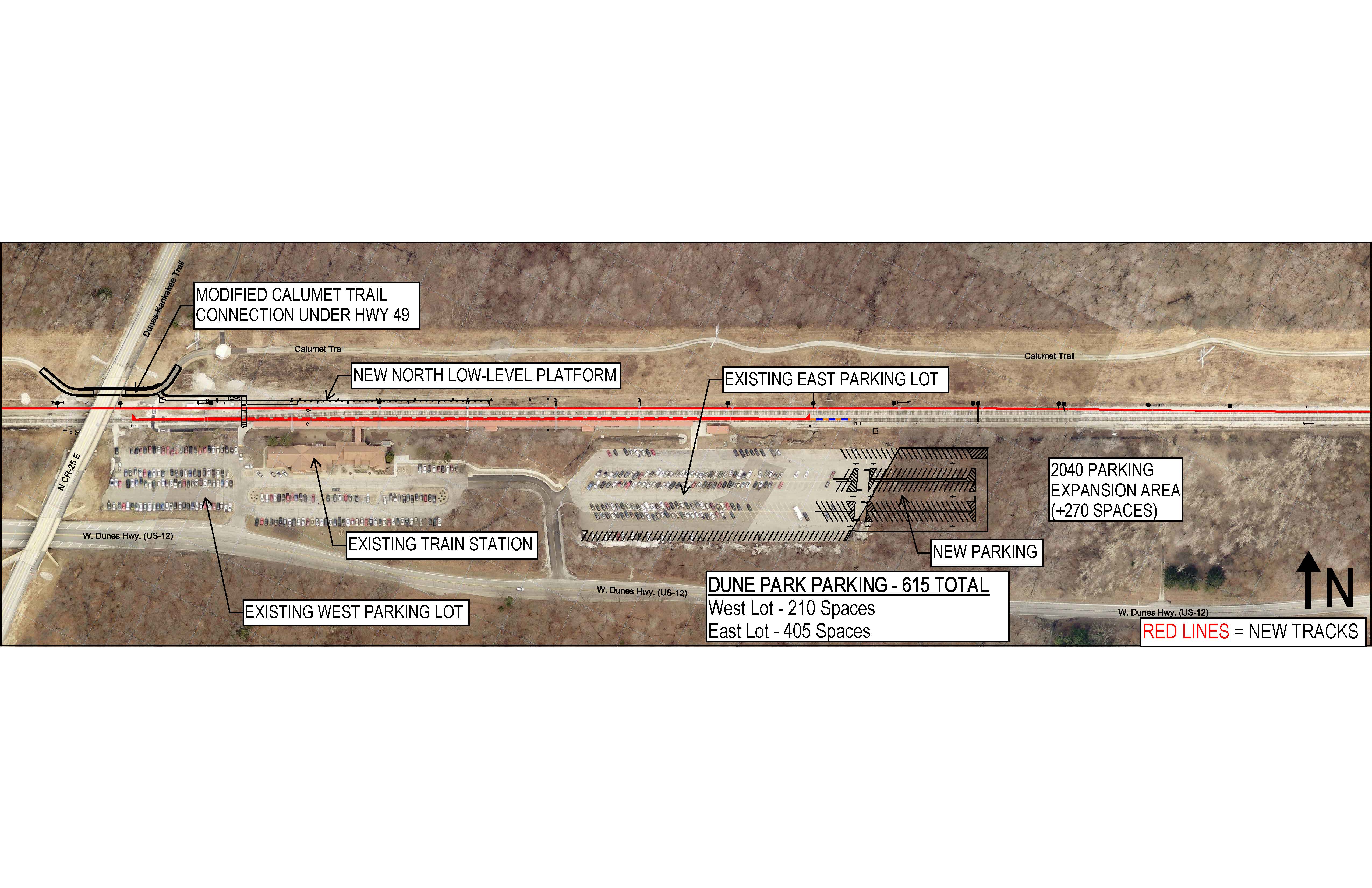
As part of a larger project to double track the South Shore Line between Gary and Michigan City, some improvements will take place at Dune Park. Unlike several other stations on the line which will see major improvements, the improvements at Dune Park will be relatively minor since the station already has two tracks and a high-level platform. The main improvement will be repurposing the northern track, which currently only exists as a siding and to allow freight trains to pass through the station without interference from the high-level platform. The improved station will add a new low-level platform adjacent to the northern track while keeping the existing high-level platform adjacent to the southern track, but will also add gauntlet track to the southern track to allow freight trains to pass through the station on that track (rather than being limited to only using the northern track) without interference from the high-level platform.[3] The new platform will be made accessible to passengers with disabilities using a mobile wheelchair lift. That will only be used occasionally, such as during service disruptions, however. During normal operations, all trains will stop at the southern high-level platform.
Bus connections[]
V-Line
- Orange Line (Friday–Sunday only)
References[]
- ^ "2018 State of the System" (PDF). Metra. August 2018. p. 185.
- ^ Longest, David E. (2007). Railroad Depots of Northern Indiana. Arcadia Publishing. p. 105. ISBN 978-0-7385-4131-0.
- ^ "Dune Park Campus". Northern Indiana Commuter Transportation District. Retrieved 19 October 2020.
External links[]
 Media related to Dune Park train station at Wikimedia Commons
- South Shore Line - Stations
- South Shore Railfan.net
- South Shore Line stations in Indiana
- Railway stations in the United States opened in 1985
- Railway stations in Porter County, Indiana