Dusauti
Dusauti | |
|---|---|
Village | |
 Map showing Dusauti (#336) in Amawan CD block | |
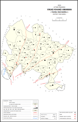
 Dusauti Location in Uttar Pradesh, India | |
| Coordinates: 26°19′18″N 81°21′51″E / 26.321575°N 81.364079°ECoordinates: 26°19′18″N 81°21′51″E / 26.321575°N 81.364079°E[1] | |
| Country India | |
| State | Uttar Pradesh |
| District | Raebareli |
| Area | |
| • Total | 1.806 km2 (0.697 sq mi) |
| Population (2011)[2] | |
| • Total | 1,562 |
| • Density | 860/km2 (2,200/sq mi) |
| Languages | |
| • Official | Hindi |
| Time zone | UTC+5:30 (IST) |
| Vehicle registration | UP-35 |

Dusauti is a village in Amawan block of Rae Bareli district, Uttar Pradesh, India.[2] As of 2011, its population is 1,562, in 233 households.[2] It has one primary school and no healthcare facilities.[2]
The 1961 census recorded Dusauti (as "Dosuti") as comprising 4 hamlets, with a total population of 632 people (316 male and 316 female), in 105 households and 96 physical houses.[3] The area of the village was given as 463 acres.[3]
The 1981 census recorded Dusauti as having a population of 848 people, in 150 households, and having an area of 357.35 hectares.[4] The main staple foods were listed as wheat and rice.[4]
References[]
- ^ Search for "Dusauti" here https://geonames.nga.mil/namesgaz/.
{{cite web}}: Missing or empty|title=(help) - ^ a b c d e "Census of India 2011: Uttar Pradesh District Census Handbook - Rae Bareli, Part A (Village and Town Directory)" (PDF). Census 2011 India. pp. 185–201. Retrieved 6 August 2021.
- ^ a b Census 1961: District Census Handbook, Uttar Pradesh (39 - Raebareli District) (PDF). Lucknow. 1965. pp. xliv-xlv of section "Rae Bareli Tahsil". Retrieved 6 August 2021.
- ^ a b Census 1981 Uttar Pradesh: District Census Handbook Part XIII-A: Village & Town Directory, District Rae Bareli (PDF). 1982. pp. 86–7. Retrieved 6 August 2021.
This Raebareli district location article is a stub. You can help Wikipedia by . |
Categories:
- Villages in Raebareli district
- Lucknow division geography stubs