Duwakot
Duwakot
दुवाकोट | |
|---|---|
Village of Changunarayan Municipality | |
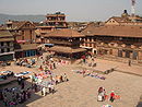
 Duwakot Location in Nepal | |
| Coordinates: 27°42′N 85°25′E / 27.70°N 85.41°ECoordinates: 27°42′N 85°25′E / 27.70°N 85.41°E | |
| Country | |
| Province | Province No. 3 |
| District | Bhaktapur |
| Population (1991) | |
| • Total | 5,157 |
| • Religions | |
| Time zone | UTC+5:45 (Nepal Time) |
| Postal code | 44802 |
| Area code(s) | 01 |

Duwakot is a beautiful hill city and former Village Development Committee that is now part of Changunarayan Municipality of Bhaktapur ktm valley in Province No. 3 of central Nepal. At the time of the 1991 Nepal census it had a population of 5157 with 905 houses in it.[1]
Located near the Changunarayan Temple and on the shore of holy river Manohara, Duwakot is one of the underdeveloped villages in Kathmandu Valley with poor transportation facility. It is surrounded by in south and in west. It is about 20 km away from centre of Kathmandu. It is located on the north of the valley. About 90% of the population is educated. Most of the people are employee in government organization. Electricity facility was started from late 1930s. Duwakot has 9 ward and each of the ward has asphalted road. The V.D.C. office is located at Ward No. 3. Jagaran Samuha is the oldest club of Duwakot established during early 1930s. located at the border of Ward no. 4 and 6. Soccer is the favourite sport. Nepal Engineering college ([2]) and Kathmandu Medical College ([3]) are the major educational institutes located in Duwakot. The oldest High school is Shree Changunarayan Madhyamik Vidyalaya, established in 2006 B.S.[citation needed]
References[]
- ^ "Nepal Census 2001". Nepal's Village Development Committees. Digital Himalaya. Archived from the original on 2008-10-12. Retrieved 2008-08-26.
- ^ http://www.nec.edu.np
- ^ http://www.kmc.edu.np

- Populated places in Bhaktapur District