Działoszyn, Lower Silesian Voivodeship
Działoszyn | |
|---|---|
Village | |
 | |
 Działoszyn | |
| Coordinates: 50°58′40″N 14°56′56″E / 50.97778°N 14.94889°ECoordinates: 50°58′40″N 14°56′56″E / 50.97778°N 14.94889°E | |
| Country | |
| Voivodeship | Lower Silesian |
| County | Zgorzelec |
| Gmina | Bogatynia |
| Time zone | UTC+1 (CET) |
| • Summer (DST) | UTC+2 (CEST) |
| Vehicle registration | DZG |
| Voivodeship roads | |


Działoszyn [d͡ʑaˈwɔʂɨn] (German: Königshain) is a village in the administrative district of Gmina Bogatynia, within Zgorzelec County, Lower Silesian Voivodeship, in south-western Poland, close to the Czech and German borders.[1]
It lies approximately 7 kilometres (4 mi) north of Bogatynia, 20 kilometres (12 mi) south of Zgorzelec, and 148 kilometres (92 mi) west of the regional capital Wrocław.
History[]
In the Early Middle Ages, the territory was inhabited by the Bieżuńczanie tribe, one of the Polish tribes.[2] Since the 11th century, it was under Polish, Czech, Hungarian and Saxon rule, and from 1871 to 1945 it was also part of Germany. After the defeat of Germany in World War II in 1945, it became again part of Poland.
Gallery[]

Saint Bartholomew church
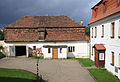
Parish house

A road

Wayside shrine


References[]
- ^ "Central Statistical Office (GUS) - TERYT (National Register of Territorial Land Apportionment Journal)" (in Polish). 2008-06-01.
- ^ "Plemiona polskie". Encyklopedia Internautica (in Polish). Retrieved 22 May 2021.
| Wikimedia Commons has media related to Działoszyn, Lower Silesian Voivodeship. |
| hide | ||
|---|---|---|
| Town and seat |  | |
| Villages | ||
This Zgorzelec County location article is a stub. You can help Wikipedia by . |
- Villages in Zgorzelec County
- Localities in Upper Lusatia
- Kingdom of Saxony
- Zgorzelec County geography stubs