East Kolaka Regency
East Kolaka Regency
Kabupaten Kolaka Timur | |
|---|---|
 Coat of arms | |
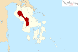 Location within Southeast Sulawesi | |
| Coordinates: 3°58′46″S 121°54′00″E / 3.97944°S 121.90000°E | |
| Country | Indonesia |
| Province | Southeast Sulawesi |
| Capital | |
| Government | |
| • Regent (Bupati) | Andi Merya Nur |
| Area | |
| • Total | 3,634.74 km2 (1,403.38 sq mi) |
| Population (2020)[1] | |
| • Total | 120,699 |
| • Density | 33/km2 (86/sq mi) |
| Time zone | UTC+8 (ICST) |
| Postcode | 93573 |
| Area code | (+62) 405 |


The East Kolaka Regency is a new and the only landlocked regency of Southeast Sulawesi, Indonesia, established in 2013 from the former eastern nine districts of the Kolaka Regency. The administrative centre lies at ; its current Regent is Andi Merya Nur. The area is 3,634.74 km², and the population at the 2020 Census was 120,699.[2]
Administration[]
On 14 December 2012, the Indonesian Parliament approved the establishment of a new East Kolaka Regency (Kolaka Timur), to be split off from the existing Kolaka Regency; the new regency - which came into effect in 2013 under Law No. 8 of 2013 - comprised nine districts of the existing Kolaka Regency; subsequently an additional three districts have been created by splitting existing districts. These are detailed below with their areas and their populations at the 2010 Census[3] and the 2020 Census.[4] The districts are subdivided into 133 villages (rural desa and urban kelurahan).
| Name | Area in km2 |
Population Census 2010 |
Population Census 2020 |
|---|---|---|---|
| Aere | 138.35 | (a) | 8,471 |
| Lambandia | 113.00 | 27,893 | 19,555 |
| Poli-Polia | 133.53 | 10,606 | 10,997 |
| Dangia | 172.72 | (b) | 8,535 |
| Ladongi | 122.88 | 23,818 | 18,333 |
| Loea | 107.94 | 6,174 | 7,242 |
| Tirawuta | 206.80 | 12,483 | 16,792 |
| Lalolae | 75.39 | 3,542 | 4,551 |
| Mowewe | 155.29 | 7,538 | 8,557 |
| Tinondo | 261.13 | 7,019 | 8,985 |
| Uluiwoi | 712.39 | 7,242 | 5,061 |
| Ueesi | 1,435.32 | (c) | 3,620 |
| Totals | 3,634.74 | 106,315 | 120,699 |
Notes: (a) the 2010 population of Aere District is included in the figure for Lambandia District, from which it was subsequently split off.
(b) the 2010 population of Dangia District is included in the figure for Ladongi District, from which it was subsequently split off.
(c) the 2010 population of Ueesi District is included in the figure for Uluiwoi District, from which it was subsequently split off.
References[]
External links[]
Regencies and cities of Southeast Sulawesi | ||
|---|---|---|
Capital: Kendari | ||
| Regencies | ||
| Cities | ||
Coordinates: 3°58′46″S 121°54′00″E / 3.97944°S 121.90000°E
This Southeast Sulawesi location article is a stub. You can help Wikipedia by . |
- Regencies of Southeast Sulawesi
- Sulawesi geography stubs