East Wall Road
This article does not cite any sources. (March 2007) |
 | |||
 | |||
| Native name | Bóthar an Phoirt Thoir (Irish) | ||
|---|---|---|---|
| Namesake | East Wall | ||
| Length | 2.0 km (1.2 mi) | ||
| Width | 17 metres (56 ft) | ||
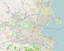
| Location | Dublin, Ireland | ||
| Postal code | D03 | ||
| Coordinates | 53°21′18″N 6°13′45.32″W / 53.35500°N 6.2292556°WCoordinates: 53°21′18″N 6°13′45.32″W / 53.35500°N 6.2292556°W | ||
| north end | North Strand Road, Annesley Bridge Road, Poplar Row | ||
| south end | J79 Roundabout (Tom Clarke Bridge and North Wall Quay) | ||

East Wall Road (Irish: Bóthar an Phoirt Thoir) runs from the junction of the East-Link drawbridge and North Wall Quay, along the side of the northern part of Dublin port to the junction of the North Strand Road and .The Point Theatre lay at its southern end before it was demolished to make way for the O2 in 2008. It marks the sharp boundary between the port and the residential area of East Wall. Indeed, much of the western side of the road north of is residential, in contrast to the other side.
East Wall road is home to The Docklands Innovation Park, Where Ireland's only special interest radio station, 103.2 Dublin City FM is located along with several other businesses and organisations
See also[]
This geographical article about the Dublin area is a stub. You can help Wikipedia by . |
This Irish road or road transport-related article is a stub. You can help Wikipedia by . |
- Streets in Dublin (city)
- Dublin Docklands
- County Dublin geography stubs
- Ireland road stubs