Easton Grey
| Easton Grey | |
|---|---|
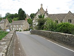 Looking across the River Avon towards the village | |
 Easton Grey Location within Wiltshire | |
| Population | 83 (in 2011)[1] |
| OS grid reference | ST880874 |
| Civil parish |
|
| Unitary authority | |
| Ceremonial county | |
| Region | |
| Country | England |
| Sovereign state | United Kingdom |
| Post town | Malmesbury |
| Postcode district | SN16 |
| Dialling code | 01666 |
| Police | Wiltshire |
| Fire | Dorset and Wiltshire |
| Ambulance | South Western |
| UK Parliament | |

Easton Grey is a small village and civil parish in north Wiltshire, England. It is on the B4040 road between Malmesbury and Sherston, about 3.5 miles (6 km) west of Malmesbury. The Church of England parish church has a 15th-century tower and was rebuilt in 1836.[2] It is a Grade II listed building.
History[]
The Fosse Way Roman road forms the eastern boundary of the parish. Near where the Fosse Way crosses the Sherston branch of the River Avon is the site of a large Romano-British roadside settlement, possibly with earlier origins.[3]
The village has a 16th-century bridge over the Avon.[4] Overlooking the river valley is Easton Grey House, a country house from the late 18th century.[5] In the 1880s the house was a retreat for the social circle known as The Souls,[6] which included Margot Asquith,[7] and the house a favourite resort of her husband H. H. Asquith during his premiership.[8]
The parish church was designated as a Grade II listed building in 1959. It is constructed of rubble stone with ashlar buttresses, stone slate roofs and a roughcast tower. The tower is at the west end and dates to the fifteenth century. It has three stages and a parapet with battlements. The main structure was built in 1836 and has a nave, a chancel and a porch on the south side. The interior has ribbed Gothic vaulting to the nave and chancel, a thirteenth century font, a Jacobean pulpit, a Gothic organ and box pews from 1836 in the nave.[9]
Local government[]
The parish is in the area of Wiltshire Council unitary authority, which performs all significant local government functions. Owing to its small population, there is no parish council; instead the first tier of local government is a parish meeting.[10]
References[]
- ^ "Easton Grey Census Information". Wiltshire Community History. Wiltshire Council. Retrieved 24 September 2014. Note ONS raw data (as opposed to this County Council figure) is for an area 'too small to publish all data for reasons of confidentiality of living people' its parish data being combined with Norton, Wiltshire into output area E00162985 so more demographic statistics will become available in a few decades from 2011
- ^ Pevsner & Cherry, 1975, page 233
- ^ Historic England. "Romano-British settlement, earthwork enclosure and a section of the Fosse Way (1013354)". National Heritage List for England. Retrieved 19 November 2015.
- ^ Historic England. "Bridge over River Avon (1356034)". National Heritage List for England. Retrieved 19 November 2015.
- ^ Historic England. "Easton Grey House (1283740)". National Heritage List for England. Retrieved 19 November 2015.
- ^ Abdy, Jane; Gere, Charlotte (1984). The Souls. Sidgwick & Jackson. p. 183. ISBN 0283989203. Retrieved 19 November 2015.
- ^ Asquith, Margot (2014). Brock, Michael; Brock, Eleanor (eds.). Margot Asquith's Great War Diary 1914-1916. Oxford University Press. p. 353. ISBN 978-0198229773. Retrieved 19 November 2015.
- ^ Meek, Sean. "Sherston - Easton Grey - Sherston". Walking World. Retrieved 4 September 2016.
- ^ Historic England. "Parish Church, Easton Grey (1023199)". National Heritage List for England. Retrieved 19 November 2015.
- ^ "Easton Grey Parish Meeting". Wiltshire Council. Retrieved 19 November 2015.
Sources[]
- Pevsner, Nikolaus (1975). Cherry, Bridget (ed.). The Buildings of England: Wiltshire. Harmondsworth: Penguin Books. p. 233. ISBN 0140710264.
External links[]
![]() Media related to Easton Grey at Wikimedia Commons
Media related to Easton Grey at Wikimedia Commons
- Villages in Wiltshire
- Civil parishes in Wiltshire