Eastriggs
| Eastriggs | |
|---|---|
 Eastriggs Location within Dumfries and Galloway | |
| Population | 1,683 [1] (2001 census) est. 1,790[2] (2006) |
| OS grid reference | NY247662 |
| Council area | |
| Lieutenancy area | |
| Country | Scotland |
| Sovereign state | United Kingdom |
| Post town | ANNAN |
| Postcode district | DG12 |
| Dialling code | 01461 |
| Police | Scotland |
| Fire | Scottish |
| Ambulance | Scottish |
| UK Parliament | |
| Scottish Parliament | |

Eastriggs is a small village located in Dumfries and Galloway in the south of Scotland, the village is located around 2 mi (3.2 km) north of the mud and sandbanks of the channel of the River Eden, which extends west into the Solway Firth.
Travelling by road Eastriggs is 3 miles (5 kilometres) to the east of Annan, 19 miles (31 kilometres) to the east of Dumfries, 5 miles (8 kilometres) to the west of Gretna, 17.7 miles (28 kilometres) to the west of Carlisle and 83.1 miles (134 kilometres) to the south of Edinburgh.
The B721 road, runs through Eastriggs and other neighbouring towns and villages connecting to the nearby A75.
History[]
Situated in the parish of Dornock, in the traditional county of Dumfriesshire, Eastriggs appears to have taken its name from the farm, or farm house, known as Eastriggs that was located in the middle of what was to become the new township.[3] The only other buildings in the area prior to World War I were a group of houses at Lowtherton (now North Road, Lowthertown); a parallel group on what is now the B721 road; an inn and a smithy where East Road joins the B721.[3]

(demolished in March 2010)
The township of Eastriggs was created as a result of the shell and ammunition crisis of June 1915 which prompted the newly founded Ministry of Munitions to create a new cordite factory.[4]
Officially designated H.M. Factory Gretna, the factory was spread over a 9-mile (14 km) site stretching from Dornock through Gretna to Longtown, Cumbria.[5] This required a huge influx of labour, and 30,000 men and women came from all over the British Commonwealth to serve as construction and factory workers.[6]
Sir Raymond Unwin, Chief Housing Architect of the housing branch of the Explosives Department of Ministry of Munitions, designed wooden housing for the workers in both Eastriggs and Gretna.[7] As a mark of respect for the immigrant workforce, the streets were named after various cities within the Commonwealth.[6]
Governance[]
Eastriggs is in the parliamentary constituency of Dumfriesshire, Clydesdale and Tweeddale, David Mundell is the current Conservative Party member of parliament.
It is part of the South Scotland region in the Scottish Parliament, being in the constituency of Dumfriesshire. Oliver Mundell of the Conservatives is the MSP.
Prior to Brexit, for the European Parliament its residents voted to elect MEP's for the Scotland constituency.
Church of St John the Evangelist[]

Designed in the Gothic style by C M Crickmer under the direction of Sir Raymond Unwin,[8] the Church of St John the Evangelist was dedicated in 1917, and was presented with a signed altar book the following year by King George V and Queen Mary, who were paying an official visit to HM Factory, Gretna.
Rail transport[]
The Glasgow South Western Line connecting Carlisle, Gretna Green and Annan passes through the currently closed Eastriggs railway station. This station is disused, but there are plans to provide a smaller replacement on the line, which has been upgraded from single to double track, enabling simultaneous passenger and freight traffic.[citation needed]
References[]
- ^ "Comparative Population Profile: Eastriggs Locality". Scotland's Census Results Online. 29 April 2001. Archived from the original on 19 May 2011. Retrieved 3 September 2008.
- ^ Statistics from the gro-scotland.gov.uk site Archived September 16, 2009, at the Wayback Machine Retrieved on 3 September 2008
- ^ Jump up to: a b Victorian OS Sheet 6
- ^ Ministry of Munitions of War, Preface
- ^ Ministry of Munitions of War, Chapter 2: Water Supply
- ^ Jump up to: a b Longtown Military Railway
- ^ Stratton & Trinder (2000)
- ^ Scottish Churches Architectural Heritage Trust Retrieved on 7 September 2008
Notes[]
- Reprinted one-inch Victorian Ordnance Survey Maps of Scotland (Sheet 6), Annan & Whithorn. 1st edition revised to 1896. Kyle of Lochalsh: Caledonian Maps. ISBN 1-85349-006-7.
- Ordnance Survey Landranger Map (number 85) - 1:50,000 scale (1.25 inches to 1 mile). ISBN 0-319-22685-9.
- Ordnance Survey Explorer Map (number 323) - 1:25,000 scale (2.5 inches to 1 mile)
- Ministry of Munitions of War, (1918). H.M. Factory, Gretna: Description of Plant and Process. Dumfries: J. Maxwell & Son for His Majesty's Stationery Office.
- Stratton, Michael and Trinder, Barrie (2000). Twentieth Century Industrial Archaeology. London: E & FN Spon. ISBN 0-419-24680-0.
- Video/DVD, (1994). The Longtown Military Railway. Carnforth: Tele Rail.
See also[]
Gallery[]
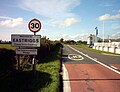
Eastriggs, The Commonwealth Village, from the east.
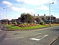
Eastriggs from the west
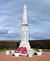
Dornock and Eastriggs war memorial


External links[]
| Wikimedia Commons has media related to Eastriggs. |
- Annandale and Eskdale
- Villages in Dumfries and Galloway