Ebnefluh
| Ebnefluh | |
|---|---|
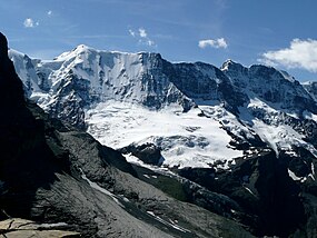 The Ebnefluh (left-centre) from the north | |
| Highest point | |
| Elevation | 3,962 m (12,999 ft) |
| Prominence | 198 m (650 ft)[1] |
| Parent peak | Gletscherhorn |
| Isolation | 1.2 km (0.75 mi) |
| Coordinates | 46°30′29″N 7°57′11″E / 46.50806°N 7.95306°ECoordinates: 46°30′29″N 7°57′11″E / 46.50806°N 7.95306°E |
| Geography | |
 Ebnefluh Location in Switzerland | |
| Location | Bern/Valais, Switzerland |
| Parent range | Bernese Alps |
| Climbing | |
| Easiest route | From Hollandia Hut |

The Ebnefluh, also known as the Äbeni Flue and the Ebenefluh, (3,962 m) is a mountain of the Bernese Alps, located on the border between the Swiss cantons of Bern and Valais. It lies towards the eastern end of the Lauterbrunnen Wall.
References[]
External links[]
| Wikimedia Commons has media related to Ebnefluh. |
This Canton of Bern location article is a stub. You can help Wikipedia by . |
Categories:
- Bernese Alps
- Mountains of the Alps
- Alpine three-thousanders
- Mountains of Valais
- Mountains of the canton of Bern
- Bern–Valais border
- Mountains of Switzerland
- Three-thousanders of Switzerland
- Canton of Bern geography stubs