Eidson Road, Texas
Eidson Road, Texas | |
|---|---|
 | |
| Coordinates: 28°40′27″N 100°28′59″W / 28.67417°N 100.48306°WCoordinates: 28°40′27″N 100°28′59″W / 28.67417°N 100.48306°W | |
| Country | United States |
| State | Texas |
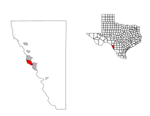
| County | Maverick |
| Area | |
| • Total | 7.5 sq mi (19.4 km2) |
| • Land | 7.1 sq mi (18.4 km2) |
| • Water | 0.4 sq mi (1.0 km2) |
| Elevation | 751 ft (229 m) |
| Population (2000) | |
| • Total | 9,348 |
| • Density | 1,315.2/sq mi (507.8/km2) |
| Time zone | UTC-6 (Central (CST)) |
| • Summer (DST) | UTC-5 (CDT) |
| FIPS code | 48-22810[1] |
| GNIS feature ID | 1852702[2] |

Eidson Road is a census-designated place (CDP) in Maverick County, Texas, United States. The population was 8,960 at the 2010 census.
Geography[]
Eidson Road is located at 28°40′27″N 100°28′59″W / 28.674215°N 100.483153°W (28.674215, -100.483153).[3]
According to the United States Census Bureau, the CDP has a total area of 7.5 square miles (19 km2), of which, 7.1 square miles (18 km2) of it is land and 0.4 square miles (1.0 km2) of it (4.95%) is water.
Demographics[]
As of the census[1] of 2000, there were 9,348 people, 2,232 households, and 2,077 families residing in the CDP. The population density was 1,315.2 people per square mile (507.6/km2). There were 2,583 housing units at an average density of 363.4/sq mi (140.3/km2). The racial makeup of the CDP was 76.48% White, 0.39% African American, 0.67% Native American, 0.04% Asian, 19.39% from other races, and 3.03% from two or more races. Hispanic or Latino of any race were 98.44% of the population.
There were 2,232 households, out of which 61.3% had children under the age of 18 living with them, 76.2% were married couples living together, 13.7% had a female householder with no husband present, and 6.9% were non-families. 6.3% of all households were made up of individuals, and 3.0% had someone living alone who was 65 years of age or older. The average household size was 4.19 and the average family size was 4.38.
In the CDP, the population was spread out, with 40.9% under the age of 18, 10.4% from 18 to 24, 26.8% from 25 to 44, 16.1% from 45 to 64, and 5.9% who were 65 years of age or older. The median age was 24 years. For every 100 females, there were 94.3 males. For every 100 females age 18 and over, there were 91.8 males.
The median income for a household in the CDP was $19,355, and the median income for a family was $20,327. Males had a median income of $18,393 versus $13,212 for females. The per capita income for the CDP was $6,115. About 39.4% of families and 41.7% of the population were below the poverty line, including 49.5% of those under age 18 and 41.0% of those age 65 or over.
Education[]
Eidson Road is served by the Eagle Pass Independent School District.
References[]
- ^ a b "U.S. Census website". United States Census Bureau. Retrieved 2008-01-31.
- ^ "US Board on Geographic Names". United States Geological Survey. 2007-10-25. Retrieved 2008-01-31.
- ^ "US Gazetteer files: 2010, 2000, and 1990". United States Census Bureau. 2011-02-12. Retrieved 2011-04-23.
Municipalities and communities of Maverick County, Texas, United States | ||
|---|---|---|
| City |  | |
| CDPs | ||
| Indian reservation | ||
| ||
- Census-designated places in Maverick County, Texas
- Census-designated places in Texas