Eketāhuna
Eketāhuna | |
|---|---|
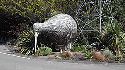 Eketāhuna Kiwi | |
 | |
| Coordinates: 40°38′49″S 175°42′14″E / 40.647°S 175.704°ECoordinates: 40°38′49″S 175°42′14″E / 40.647°S 175.704°E | |
| Country | New Zealand |
| Region | Manawatū-Whanganui |
| Territorial authority | Tararua District |
| Ward | Southern Tararua Ward |
| Government | |
| • Mayor of Tararua | Tracey Collis |
| • Wairarapa MP | Kieran McAnulty |
| • Ikaroa-Rāwhiti MP | Meka Whaitiri |
| Area | |
| • Total | 4.15 km2 (1.60 sq mi) |
| Population (2018)[2] | |
| • Total | 504 |
| • Density | 120/km2 (310/sq mi) |
| Time zone | UTC+12 (NZST) |
| • Summer (DST) | UTC+13 (NZDT) |
| Postcode | 4900 |
| Area code(s) | 06 |

Eketāhuna is a small rural settlement, in the south of the Tararua District and the Manawatū-Whanganui region of New Zealand's North Island.
The town is located at eastern foot of the Tararua Ranges, 35 kilometres north of Masterton and a similar distance south of Palmerston North. It is situated on State Highway 2, on the eastern bank of the Mākākahi River.[3]
Eketāhuna has become synonymous with stereotypes of remote rural New Zealand towns, with New Zealanders colloquially referring to the town in the same way other English speakers refer to Timbuktu.[4]
The New Zealand Ministry for Culture and Heritage gives a translation of "land on the sandbank" for Eketāhuna.[5] The name sounds like a sentence in Afrikaans which translates to "I have a chicken", making it amusing to immigrant Afrikaans-speaking South Africans in New Zealand.[6]
Geography[]
The corresponding Statistics New Zealand statistical area covers an area of 892.66 km².[7]
The Pukaha / Mount Bruce National Wildlife Centre is located to the south of the town.[6]
History[]

Early settlement[]
Eketāhuna was settled in 1872, under the name Mellemskov.[6] It was renamed soon after its founding.[8]
Modern history[]
The population of Eketāhuna and the wider area has plummeted in the 21st century, dropping from 1,920 in 1996 to just 630 in 2013.[9]
On 20 January 2014, the town was the epicenter of the 2014 Eketāhuna earthquake. Measuring 6.2 on the Richter magnitude scale, the quake caused moderate damage all over the southern North Island.[10]
In July 2020, the name of the town was officially gazetted as Eketāhuna by the New Zealand Geographic Board.[11]
Demography[]
Eketāhuna is defined by Statistics New Zealand as a rural settlement and covers 4.15 km2 (1.60 sq mi). It is part of the wider Nireaha-Eketahuna statistical area, which covers 892.63 km2 (344.65 sq mi).[1]
The population of Eketāhuna was 504 in the 2018 New Zealand census, an increase of 60 (13.5%) since the 2013 census, and an increase of 48 (10.5%) since the 2006 census. There were 255 males and 252 females, giving a sex ratio of 1.01 males per female. Ethnicities were 429 people (85.1%) European/Pākehā, 158 (31.3%) Māori, 15 (3.0%) Pacific peoples, and 12 (2.4%) Asian (totals add to more than 100% since people could identify with multiple ethnicities). Of the total population, 84 people (16.7%) were under 15 years old, 87 (17.3%) were 15–29, 231 (45.8%) were 30–64, and 102 (20.2%) were over 65.[2]
Nireaha-Eketāhuna[]
Nireaha-Eketāhuna statistical area has an estimated population of 1,630 as of June 2020,[12] with a population density of 1.83 people per km².
| Year | Pop. | ±% p.a. |
|---|---|---|
| 2006 | 1,497 | — |
| 2013 | 1,452 | −0.44% |
| 2018 | 1,566 | +1.52% |
| Source: [13] | ||
Nireaha-Eketāhuna, which also includes Alfredton, had a population of 1,566 at the 2018 New Zealand census, an increase of 114 people (7.9%) since the 2013 census, and an increase of 69 people (4.6%) since the 2006 census. There were 597 households. There were 816 males and 750 females, giving a sex ratio of 1.09 males per female. The median age was 37.7 years (compared with 37.4 years nationally), with 366 people (23.4%) aged under 15 years, 261 (16.7%) aged 15 to 29, 726 (46.4%) aged 30 to 64, and 207 (13.2%) aged 65 or older.
Ethnicities were 89.8% European/Pākehā, 22.6% Māori, 1.1% Pacific peoples, 1.7% Asian, and 1.9% other ethnicities (totals add to more than 100% since people could identify with multiple ethnicities).
The proportion of people born overseas was 8.8%, compared with 27.1% nationally.
Although some people objected to giving their religion, 57.7% had no religion, 28.0% were Christian, 0.4% were Hindu, 0.2% were Buddhist and 3.3% had other religions.
Of those at least 15 years old, 138 (11.5%) people had a bachelor or higher degree, and 291 (24.2%) people had no formal qualifications. The median income was $27,600, compared with $31,800 nationally. The employment status of those at least 15 was that 594 (49.5%) people were employed full-time, 246 (20.5%) were part-time, and 60 (5.0%) were unemployed.[13]
Economy[]

In 2018, 5.0% of the workforce worked in manufacturing, 6.1% worked in construction, 5.0% worked in hospitality, 1.4% worked in transport, 3.9% worked in education, and 6.4% worked in healthcare.[9]
Transport[]
As of 2018, among those who commute to work, 46.4% drove a car and 3.2% rode in a car. No one commuted by public transport, walked, ran or cycled.[9]
Education[]
Eketāhuna School is a co-educational state primary school for Year 1 to 8 students,[14][15] with a roll of 119 as of March 2021.[16]
Notable people[]
- Ellen Anderson (1882–1978), district nurse in Eketāhuna
- Tania Lineham, born 1966 in Eketāhuna. Royal Society of New Zealand, Science and Technology Teacher Fellowship in 1999 and the Prime Minister's Science Teacher Prize in 2015.
See also[]
Notes[]
- ^ Jump up to: a b "ArcGIS Web Application". statsnz.maps.arcgis.com. Retrieved 3 May 2021.
- ^ Jump up to: a b "Age and sex by ethnic group (grouped total response), for census usually resident population counts, 2006, 2013, and 2018 Censuses (urban rural areas)". Statistics New Zealand. Retrieved 3 May 2021.
- ^ "Eketahuna Travel Guide". Jasons Travel Media.
- ^ Davison, Isaac (29 August 2017). "Heartbeat: Eketahuna makes a community-led recovery". New Zealand Media and Entertainment. The New Zealand Herald.
- ^ "1000 Māori place names". New Zealand Ministry for Culture and Heritage. 6 August 2019.
- ^ Jump up to: a b c Easther, Elisabeth (20 March 2015). "Kia ora: Eketahuna". New Zealand Media and Entertainment. The New Zealand Herald.
- ^ "Statistical Area 2 2018 (generalised) GIS" (Data table). stats.govt.nz. Statistics New Zealand.
- ^ "Horizons Regional Council – Regional Policy Statement". horizons.govt.nz. Horizons Regional Council.
- ^ Jump up to: a b c "Place Summary – Nireaha-Eketahuna". Stats NZ. Statistics New Zealand.
- ^ "6.2-magnitude earthquake hits lower North Island". The New Zealand Herald. 20 January 2014. Retrieved 17 June 2016.
- ^ "Notice of approved official geographic names" (PDF). New Zealand Gazette. 16 July 2020. Retrieved 24 July 2020.
- ^ "Population estimate tables - NZ.Stat". Statistics New Zealand. Retrieved 22 October 2019.
- ^ Jump up to: a b "Statistical area 1 dataset for 2018 Census". Statistics New Zealand. March 2020. Nireaha-Eketahuna (233700). 2018 Census place summary: Nireaha-Eketahuna
- ^ "Official School Website". eketahuna.school.nz.
- ^ "Ministry of Education School Profile". educationcounts.govt.nz. Ministry of Education.
- ^ "Education Review Office Report". ero.govt.nz. Education Review Office.
External links[]
| Wikimedia Commons has media related to Eketahuna. |
- Eketahuna information at the Wayback Machine (archived 24 July 2014)
- Populated places in Manawatū-Whanganui
- Tararua District