Ekwangatana
Ekwangatana | |
|---|---|
 Ekwangatana | |
| Coordinates: 2°53′11″N 24°05′20″E / 2.8865°N 24.0889°ECoordinates: 2°53′11″N 24°05′20″E / 2.8865°N 24.0889°E | |
| Country | Democratic Republic of the Congo |
| Province | Bas-Uélé |
| Elevation | 417 m (1,368 ft) |

Ekwangatana is the location of a post established by Belgian officers in what is now Bas-Uélé province in the Democratic Republic of the Congo.
Location[]
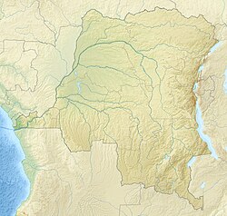
Ekwangatana is near the present settlement of where the Rubi River and Likati River converge to form the Itimbiri River. It is at an elevation of 417 metres (1,368 ft).[1]
History[]
Ekwangatana was founded as a government post in May 1890 by Léon Roget and Jules Milz, who entrusted it to an African officer.[2] The Belgian limited company (COMUELE) was created in June 1919 as a joint venture between the Société commerciale et Minière du Congo (Cominière) and the English Lever Brothers. In 1926 it established the Ekwangatana coffee plantations.[3]
A station was set up in Ekwangatana for a magnetic survey of the Belgian Congo in 1936–1937. It was on the left bank of the Itimbiri (Rubi), in front of the workers' camp of the Comuele Ekwangatana plantation, in a small clearing in the forest about 250 meters south-southwest of the coffee pulping plant.[4] This survey gave an altitude of 375 metres (1,230 ft).[5]
Notes[]
- ^ Ekwangatana : MapCarta.
- ^ Omasombo Tshonda 2011, p. 143.
- ^ Ergo.
- ^ Hermans 1951, p. 15.
- ^ Hermans 1951, p. 41.
Sources[]
- "Ekwangatana", MapCarta, retrieved 2020-08-31
- Ergo, André-Bernard, La COMUELE (PDF), retrieved 2020-08-31
- Hermans, L. (1951), Carte Magnétique Du Congo Belge (PDF) (in French), Institut Royal Colonial Belge, retrieved 2020-08-31
- Omasombo Tshonda, Jean, ed. (2011), Huat Uele : Trésor (PDF), Le Cri édition, Musée royal de l’Afrique centrale, ISBN 978-2-8710-6578-4, retrieved 2020-08-31
- Populated places in Bas-Uélé