El Tajín National Airport
El Tajín National Airport Aeropuerto Nacional El Tajín | |||||||||||
|---|---|---|---|---|---|---|---|---|---|---|---|
 | |||||||||||
| Summary | |||||||||||
| Airport type | Public | ||||||||||
| Operator | Aeropuertos y Servicios Auxiliares | ||||||||||
| Serves | Poza Rica, Veracruz | ||||||||||
| Location | Tihuatlán, Veracruz | ||||||||||
| Elevation AMSL | 497 ft / 151 m | ||||||||||
| Coordinates | 20°36′09″N 97°27′39″W / 20.60250°N 97.46083°W | ||||||||||
| Map | |||||||||||
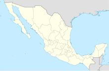 PAZ Location of airport in Mexico | |||||||||||
| Runways | |||||||||||
| |||||||||||
| Statistics (2020) | |||||||||||
| |||||||||||
Source: Aeropuertos y Servicios Auxiliares | |||||||||||

El Tajín National Airport (IATA: PAZ, ICAO: MMPA) is an international airport located in Tihuatlán, Veracruz, Mexico, near Poza Rica. The airport is named after the archeological site of El Tajín. It handles commercial air traffic for the cities of Poza Rica and Túxpam. Aeropuertos y Servicios Auxiliares, a federal government-owned corporation, operates the airport.
In 2019, the airport handled 27,083 passengers, and in 2020 it handled 4,146 passengers.[1]
Statistics[]
Passengers[]
Poza Rica Airport Passengers.
See source Wikidata query.
See also[]
References[]
- ^ "Estadística Operacional de los Aeropuertos de la Red ASA" (in Spanish). February 2021. Retrieved March 8, 2021.
External links[]
This article about a Mexican airport is a stub. You can help Wikipedia by . |
Categories:
- Airports in Veracruz
- Mexican airport stubs