Electoral district of Werribee
| Werribee Victoria—Legislative Assembly | |
|---|---|
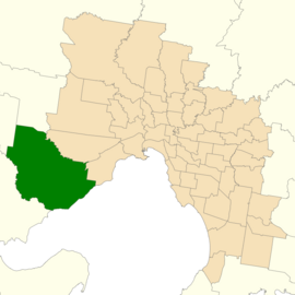 Location of Werribee (dark green) in Greater Melbourne | |
| State | Victoria |
| Dates current | 1976–2002, 2014– |
| MP | Tim Pallas |
| Party | Labor |
| Namesake | Suburb of Werribee |
| Electors | 46,282 (2018) |
| Area | 377 km2 (145.6 sq mi) |
| Demographic | Outer metropolitan |
The electoral district of Werribee is an electoral district of the Legislative Assembly in the Australian state of Victoria. It has existed in two incarnations, first from 1976 to 2002,[1] and was created again in the 2013 redistribution and will come into effect at the 2014 state election.[2]
Based on the rapidly growing outer south west suburbs of Melbourne, it takes in areas from Tarneit and Lara. It covers the suburbs of Werribee, Wyndham Vale, and the rural areas surrounding these suburbs to the south and west.[3]
Werribee was estimated to be a safe Labor seat with a margin of 11.4%, and was held by Labor with a further 4.2% swing towards them at the 2014 state election.[4]
Members[]
| First incarnation (1976–2002) | |||
|---|---|---|---|
| Member | Party | Term | |
| Neville Hudson | Liberal | 1976–1979 | |
| Ken Coghill | Labor | 1979–1996 | |
| Mary Gillett | Labor | 1996–2002 | |
| Second incarnation (2014–present) | |||
|---|---|---|---|
| Member | Party | Term | |
| Tim Pallas | Labor | 2014–present | |
Election results[]
| Party | Candidate | Votes | % | ±% | |
|---|---|---|---|---|---|
| Labor | Tim Pallas | 17,539 | 45.41 | −11.20 | |
| Independent | Joe Garra | 7,685 | 19.90 | +19.90 | |
| Liberal | Gayle Murphy | 6,641 | 17.19 | −11.55 | |
| Greens | Jay Dessi | 2,522 | 6.53 | −1.96 | |
| Independent | Rachel Carling-Jenkins | 2,086 | 5.40 | +5.40 | |
| Democratic Labour | Kathryn Breakwell | 1,175 | 3.04 | +3.04 | |
| Independent | Pratibha Sharma | 628 | 1.63 | +1.63 | |
| Independent | Thanh Nga Ly | 346 | 0.90 | +0.90 | |
| Total formal votes | 38,622 | 93.25 | −0.38 | ||
| Informal votes | 2,796 | 6.75 | +0.38 | ||
| Turnout | 41,418 | 89.49 | −3.25 | ||
| Two-party-preferred result | |||||
| Labor | Tim Pallas | 24,209 | 62.55 | −3.10 | |
| Liberal | Gayle Murphy | 14,494 | 37.45 | +3.10 | |
| Two-candidate-preferred result | |||||
| Labor | Tim Pallas | 22,701 | 58.78 | −6.88 | |
| Independent | Joe Garra | 15,921 | 41.22 | +41.22 | |
| Labor hold | Swing | N/A | |||
References[]
- ^ "Re-Member (Former Members)". State Government of Victoria. Retrieved 28 May 2014.
- ^ "Summary of Changes". Victorian Electoral Boundary Commission. Archived from the original on 17 October 2013. Retrieved 17 October 2013.
- ^ "Map of Werribee District". Victorian Electoral Boundaries Commission.
- ^ Green, Antony. "2013 Victorian Redistribution Analysis of Electoral Boundaries". ABC.
- ^ State Election 2018: Werribee District, VEC.
External links[]
Coordinates: 37°55′S 144°40′E / 37.917°S 144.667°E

This Victoria (Australia) government-related article is a stub. You can help Wikipedia by . |
- Electoral districts of Victoria (Australia)
- 1976 establishments in Australia
- 2002 disestablishments in Australia
- 2014 establishments in Australia
- Werribee, Victoria
- Victoria (Australia) government stubs