Encinal, Texas
Encinal, Texas | |
|---|---|
Town | |
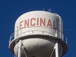 Encinal water tower | |
 Location of Encinal, Texas | |
 | |
| Coordinates: 28°2′30″N 99°21′22″W / 28.04167°N 99.35611°WCoordinates: 28°2′30″N 99°21′22″W / 28.04167°N 99.35611°W | |
| Country | United States |
| State | Texas |
| County | La Salle |
| Area | |
| • Total | 0.43 sq mi (1.12 km2) |
| • Land | 0.43 sq mi (1.12 km2) |
| • Water | 0.00 sq mi (0.00 km2) |
| Elevation | 558 ft (170 m) |
| Population (2020) | |
| • Total | 540 |
| • Density | 1,300/sq mi (480/km2) |
| Time zone | UTC-6 (Central (CST)) |
| • Summer (DST) | UTC-5 (CDT) |
| ZIP code | 78019 |
| Area code(s) | 956 |
| FIPS code | 48-24240[2] |
| GNIS feature ID | 1335452[3] |
| Website | https://www.cityofencinal.com/ |
Encinal (/ˌɛnsɪˈnɔːl/ EN-sin-AWL) is a town in La Salle County, Texas, United States. The population was 540 at the 2020 census. Interstate 35 Business runs through the community. There are few businesses in Encinal; most have closed along the main street.
Railroad officials named the town for the Spanish word for oak grove. The population peaked in 1937 at eight hundred residents.
History[]
Encinal may be named for the Spanish word for a holm or holly oak grove.[4] The town was supposed to be the county seat for Encinal County which was established on February 1, 1856 and was to consist of the eastern portion of Webb County, Texas. The county was never organized and was finally dissolved on March 12, 1899. The Encinal territory was absorbed into Webb County, and Encinal became part of La Salle County.
Geography[]
Encinal is located at 28°2′30″N 99°21′22″W / 28.04167°N 99.35611°W (28.041584, −99.356192).[5]
According to the United States Census Bureau, the city has a total area of 0.4 square miles (1.0 km2), all of it land.
Climate[]
The climate in this area is characterized by hot, humid summers and generally mild to cool winters. According to the Köppen Climate Classification system, Encinal has a humid subtropical climate, abbreviated "Cfa" on climate maps.[6]
| Climate data for Encinal, Texas | |||||||||||||
|---|---|---|---|---|---|---|---|---|---|---|---|---|---|
| Month | Jan | Feb | Mar | Apr | May | Jun | Jul | Aug | Sep | Oct | Nov | Dec | Year |
| Average high °F (°C) | 67.3 (19.6) |
72.1 (22.3) |
79.8 (26.6) |
87.2 (30.7) |
93.4 (34.1) |
98.3 (36.8) |
99.3 (37.4) |
100.1 (37.8) |
94.3 (34.6) |
86.8 (30.4) |
77.1 (25.1) |
68.0 (20.0) |
85.3 (29.6) |
| Daily mean °F (°C) | 55.0 (12.8) |
58.9 (14.9) |
65.6 (18.7) |
73.0 (22.8) |
80.4 (26.9) |
85.4 (29.7) |
86.4 (30.2) |
87.0 (30.6) |
82.2 (27.9) |
73.7 (23.2) |
63.9 (17.7) |
55.2 (12.9) |
72.2 (22.4) |
| Average low °F (°C) | 42.8 (6.0) |
45.6 (7.6) |
51.5 (10.8) |
58.7 (14.8) |
67.4 (19.7) |
72.5 (22.5) |
73.5 (23.1) |
74.0 (23.3) |
70.2 (21.2) |
60.7 (15.9) |
50.8 (10.4) |
42.3 (5.7) |
59.2 (15.1) |
| Average precipitation inches (mm) | 1.3 (33) |
1.1 (28) |
2.0 (51) |
1.5 (38) |
2.8 (71) |
2.8 (71) |
2.7 (69) |
1.6 (41) |
2.5 (64) |
2.1 (53) |
1.1 (28) |
1.3 (33) |
22.8 (580) |
| Source: [7] | |||||||||||||
Transportation[]
Highways[]
 Interstate Highway 35, exit 38, Runs directly through town to the east.
 Texas State Highway 44. Runs through town, Ends at US 83 far west of town.
 US 83. Bypasses town to the Far West.
Air travel[]
Demographics[]
| Historical population | |||
|---|---|---|---|
| Census | Pop. | %± | |
| 1890 | 562 | — | |
| 1980 | 704 | — | |
| 1990 | 620 | −11.9% | |
| 2000 | 629 | 1.5% | |
| 2010 | 559 | −11.1% | |
| 2020 | 540 | −3.4% | |
| U.S. Decennial Census[8] | |||
As of the census[2] of 2000, there were 629 people, 215 households, and 159 families residing in the city. The population density was 1,616.4 people per square mile (622.7/km2). There were 276 housing units at an average density of 709.2/sq mi (273.2/km2). The racial makeup of the city was 74.56% White, 0.16% African American, 0.32% Native American, 23.05% from other races, and 1.91% from two or more races. Hispanic or Latino of any race were 91.26% of the population.
There were 215 households, out of which 40.5% had children under the age of 18 living with them, 51.2% were married couples living together, 17.7% had a female householder with no husband present, and 25.6% were non-families. 22.3% of all households were made up of individuals, and 12.1% had someone living alone who was 65 years of age or older. The average household size was 2.93 and the average family size was 3.50.
In the city, the population was spread out, with 31.8% under the age of 18, 9.9% from 18 to 24, 24.6% from 25 to 44, 19.7% from 45 to 64, and 14.0% who were 65 years of age or older. The median age was 31 years. For every 100 females, there were 101.0 males. For every 100 females age 18 and over, there were 102.4 males.
The median income for a household in the city was $14,853, and the median income for a family was $18,125. Males had a median income of $18,250 versus $13,750 for females. The per capita income for the city was $6,928. About 37.2% of families and 38.1% of the population were below the poverty line, including 42.9% of those under age 18 and 30.2% of those age 65 or over.
Education[]
- Encinal is within the Cotulla Independent School District.
Notable people[]
- , an artist of South Texas ranching life, resides in Encinal, former professor at Texas A&M International University in Laredo
- Rodney Lewis, CEO of , has a ranch in Encinal.,[9]
- George Strait country music artist lives on his 8,000+ acre ranch near Encinal
Juan Light Salinas (1901–1995) lived on his ranch south of Encinal; world class tie-down calf roper, National Cowboy Hall of Fame inductee 1991;made the World Championship Rodeo at Madison Square Garden, New York City, 1936 to 1946. Subject of Tio Cowboy, his biography, by his nephew Ricardo D. Palacios, (Texas A & M University Press).
Gallery[]
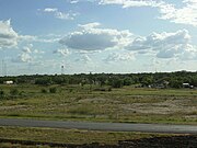
A glimpse of Encinal from Interstate 35.

Cactus around Encinal & La Salle County

Veteran's Monument in Encinal

An old fence post in Encinal


References[]
- ^ "2019 U.S. Gazetteer Files". United States Census Bureau. Retrieved August 7, 2020.
- ^ a b "U.S. Census website". United States Census Bureau. Retrieved January 31, 2008.
- ^ "US Board on Geographic Names". United States Geological Survey. October 25, 2007. Retrieved January 31, 2008.
- ^ Encinal, Texas. TexasEscapes.com.
- ^ "US Gazetteer files: 2010, 2000, and 1990". United States Census Bureau. February 12, 2011. Retrieved April 23, 2011.
- ^ Climate Summary for Encinal, Texas
- ^ "Monthly Averages for Encinal, TX". weatherbase.com. Retrieved December 24, 2017.
- ^ "Census of Population and Housing". Census.gov. Retrieved June 4, 2015.
- ^ Helman, Christopher; Jesse Bogan (August 13, 2008), "A Wildcatter in Love with Warbirds", Forbes Magazine
| Wikimedia Commons has media related to Encinal, Texas. |
External links[]
- Encinal, Texas from the Handbook of Texas Online
Municipalities and communities of La Salle County, Texas, United States | ||
|---|---|---|
| Cities |  | |
| CDP | ||
| Other communities | ||
| Ghost town | ||
| ||
- Cities in Texas
- Cities in La Salle County, Texas