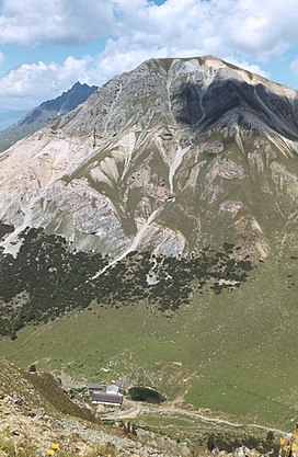
Endkopf
| Endkopf | |
|---|---|
 | |
| Highest point | |
| Elevation | 2,652 m (8,701 ft) |
| Coordinates | 46°47′37″N 10°33′54″E / 46.79361°N 10.56500°ECoordinates: 46°47′37″N 10°33′54″E / 46.79361°N 10.56500°E |
| Geography | |
| Location | South Tyrol, Italy |
| Parent range | Ötztal Alps |

The Endkopf (Italian: Cima Termine; German: Endkopf) is a mountain in the Ötztal Alps in South Tyrol, Italy.
References[]
- : Alpenvereinsführer Ötztaler Alpen. Bergverlag Rudolf Rother, Munich, 2006, ISBN 3-7633-1123-8
External links[]
![]() Media related to Endkopf at Wikimedia Commons
Media related to Endkopf at Wikimedia Commons
Categories:
- Mountains of the Alps
- Mountains of South Tyrol
- Ötztal Alps