Engelhartstetten
Engelhartstetten | |
|---|---|
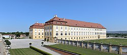 Castle Schlosshof | |
 Coat of arms | |
 Engelhartstetten Location within Austria | |
| Coordinates: 48°11′N 16°53′E / 48.183°N 16.883°ECoordinates: 48°11′N 16°53′E / 48.183°N 16.883°E | |
| Country | Austria |
| State | Lower Austria |
| District | Gänserndorf |
| Government | |
| • Mayor | Josef Reiter (ÖVP) |
| Area | |
| • Total | 65.66 km2 (25.35 sq mi) |
| Elevation | 143 m (469 ft) |
| Population (2018-01-01)[2] | |
| • Total | 2,055 |
| • Density | 31/km2 (81/sq mi) |
| Time zone | UTC+1 (CET) |
| • Summer (DST) | UTC+2 (CEST) |
| Postal code | A-2292 |
| Area code | +43 2214 |
| Vehicle registration | GF |
| Website | www.engelhartstetten.at |

Engelhartstetten is a town in the district of Gänserndorf in the Austrian state of Lower Austria.
Geography[]
Engelhartstetten lies near Vienna in the southeast corner of the Marchfeld. On the east is the and on the south the Danube. About 12 percent of the municipality is forested.
History[]
- The Battle of Kressenbrunn was fought in July 1260 near Groissenbrunn.
References[]
- "Municipal data for Engelhartstetten". Statistik Austria.
- ^ "Dauersiedlungsraum der Gemeinden Politischen Bezirke und Bundesländer - Gebietsstand 1.1.2018". Statistics Austria. Retrieved 10 March 2019.
- ^ "Einwohnerzahl 1.1.2018 nach Gemeinden mit Status, Gebietsstand 1.1.2018". Statistics Austria. Retrieved 9 March 2019.
| Authority control |
|---|
This Lower Austria location article is a stub. You can help Wikipedia by . |
Categories:
- Cities and towns in Gänserndorf District
- Croatian communities in Austria
- Lower Austria geography stubs