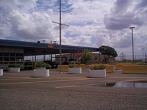
Falcon Dam Port of Entry
This article does not cite any sources. (September 2012) |
| Falcon Dam Port of Entry | |
|---|---|
 Falcon Dam Port of Entry | |
| Location | |
| Country | United States |
| Location | FM 2098 Spur, Falcon Heights, Texas 78545 (Falcon Dam) |
| Coordinates | 26°33′12″N 99°08′40″W / 26.553225°N 99.144487°WCoordinates: 26°33′12″N 99°08′40″W / 26.553225°N 99.144487°W |
| Details | |
| Opened | 1954 |
| Hours | 7:00 AM-9:00 PM |
| Exit Port | Nuevo Laredo |
| Statistics | |
| 2005 Cars | 147,101 |
| 2005 Trucks | 0 |
| Pedestrians | (not reported, but believed to be small in number) |
| Website www | |

Falcon Dam Port of Entry is a port of entry to the United States on the Mexican border.
The Falcon Dam was built in 1954 to mitigate the effects of flooding conditions that had long plagued the towns and cities on the Texas-Mexico border, and to provide hydro-electric power for the Rio Grande Valley. The Falcon Dam Port of Entry is essentially a replacement for the former Zapata Port of Entry, which was situated at a bridge in the town of Zapata, Texas. When the dam was completed, the town was moved to higher ground, and the Zapata Bridge now lies at the bottom of Falcon Lake.
References[]
See also[]
This article about a location in the Mexican state of Tamaulipas is a stub. You can help Wikipedia by . |
 | This article about a location in Starr County, Texas is a stub. You can help Wikipedia by . |
- Mexico–United States border crossings
- 1954 establishments in Texas
- Buildings and structures in Starr County, Texas
- Buildings and structures completed in 1954
- Northern Mexico geography stubs
- South Texas geography stubs