Fanafjorden
| Fanafjorden | |
|---|---|
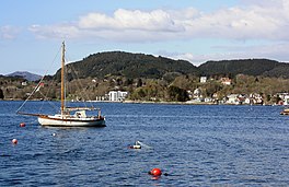 View of the fjord and Fanahammeren | |
 Fanafjorden Location of the village | |
| Location | Vestland county, Norway |
| Coordinates | 60°15′18″N 5°18′47″E / 60.2551°N 5.3131°ECoordinates: 60°15′18″N 5°18′47″E / 60.2551°N 5.3131°E |
| Primary outflows | |
| Basin countries | Norway |
| Max. length | 8.5 kilometres (5.3 mi) |
| Max. depth | 160 metres (520 ft) |
| Settlements | Fanahammeren |


Fanafjorden is a fjord in the city-municipality of Bergen in Vestland county, Norway. The 8.5-kilometre (5.3 mi) long fjord is a fjord arm that branches off of the fjord and cuts into the large Bergen Peninsula. The deepest point in the fjord reaches 160 metres (520 ft) below sea level. The fjord is located between the small Krokeide peninsula (on the south) and the village area of Milde in Ytrebygda, and forms a natural boundary between the city boroughs of Fana and Ytrebygda. The urban area of Fanahammeren lies at the eastern end of the fjord.[1]
References[]
- ^ Store norske leksikon. "Fanafjorden" (in Norwegian). Retrieved 2014-09-01.
This article related to Bergen, Norway is a stub. You can help Wikipedia by . |
Categories:
- Geography of Bergen
- Fjords of Vestland
- Bergen stubs