Farafangana
Farafangana | |
|---|---|
City | |
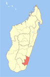
 Location of Farafangana | |
| Country | Madagascar |
| Region | Atsimo-Atsinanana |
| Area | |
| • Total | 27.0 km2 (10.4 sq mi) |
| Elevation | 1 m (3 ft) |
| Population (2018 census) | |
| • Total | 34,676 |
| • Density | 1,300/km2 (3,300/sq mi) |
| Time zone | UTC+3 (EAT) |
| Climate | Af |
| Website | www |
Farafangana is a city (commune urbaine) on the south-east coast of Madagascar and capital of the Atsimo-Atsinanana region.
Location[]
Farafangana is the capital of the region Atsimo-Atsinanana located approximately 400 kilometres south of the capital Antananarivo. It is at the southern end of the Canal des Pangalanes,[1] with the mouth of the Manampatrana River located on the north side of the town. It is 106km south of Manakara, about 2.5 hours travel time away.[2]
Settlements located to the north include , , and , with to the west. To the south are , Manambotra Atsimo and .[3]
Economy[]
There is an airport in Farafangana (Farafangana Airport). One of the main crops in the region is pepper.[4]
Population[]
Natives are mainly from ethnic groups Antefasy, , Antesaka and Zafisoro.
Education[]
A regional centre for distance education (CRTE) of the Centre National de Télé-Enseignement de Madagascar (CNETMAD) is located in Farafangana.
Tourism[]
The Manombo Reserve is located at 25 km to Farafangana.[5]
See also[]
- Diocese of Farafangana
- Manombo Reserve
References[]
- ^ Madagascar & Comoros, p. 232 (Lonely Planet, 2008)
- ^ Madagascar 2014-2015 Petit Futé, p. 249 (2013)
- ^ http://www.fallingrain.com/world/MA/2/Farafangana.html
- ^ (in French) www.commerce.gov.mg Archived 2013-03-24 at the Wayback Machine
- ^ travalmadagascar.org
Coordinates: 22°49′S 47°49′E / 22.817°S 47.817°E

| show Authority control |
|---|
This Atsimo-Atsinanana location article is a stub. You can help Wikipedia by . |
- Cities in Madagascar
- Populated places in Atsimo-Atsinanana
- Regional capitals in Madagascar
- Atsimo-Atsinanana geography stubs