Farim
This article includes a list of general references, but it remains largely unverified because it lacks sufficient corresponding inline citations. (December 2016) |
Farim | |
|---|---|
 Coat of arms | |
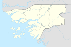 Farim Location in Guinea-Bissau | |
| Coordinates: 12°29′2″N 15°13′18″W / 12.48389°N 15.22167°W | |
| Country | Guinea-Bissau |
| Region | Oio Region |
| Founded | 1641 |
| Elevation | 2 m (7 ft) |
| Population (2009) | |
| • Total | 8,661 |

Farim is a town of northern Guinea-Bissau. It sits on the north bank of the Farim/Cacheu River, about 215 km (135 miles) up the river from Cacheu. Population 8,661 (2009 census).[1]
History[]
Farim was founded about 1641 by the Captain-Major of Cacheu, who recruited lançados from Geba to move to where they would be less vulnerable to attack by African tribes. The name derived from , the title of the local Mandinka people's ruler. For their part, the Mandinkas and Soninke called the settlement Tubabodaga ("village of the whites"). It was well-situated as a port, since the river was continuously navigable by sailing vessels from Cacheu.
It became a presídio (garrisoned place) though an order dated 10 November 1696, in reaction to an anticipated attack from nearby . The area remained generally peaceful, and the defenses gradually deteriorated.
It was a base for operations against Oio in 1897 and 1902. Farim started to grow in earnest in the 1910s, with over twenty trading firms based there, and became a vila (town) in 1918.
Farim had become a by 1925, and experienced an influx of Lebanese and Syrian merchants, dealing in peanuts and timber. Its economy was hit hard by the independence struggle in the 1960s and 1970s.
Sports[]
There are several sports clubs (notably football and athletics) in Farim and area, including SC Farim.
Named after[]
A crater on Mars is named after the town.[2]
References[]
- ^ População por região, sector e localidades por sexo censo 2009, Instituto Nacional de Estatística Guiné-Bissau
- ^ "Gazetteer of Planetary Nomenclature | Farim on Mars". usgs.gov. International Astronomical Union. Retrieved 2018-01-10.
- Richard Andrew Lobban Jr. and Peter Karibe Mendy, Historical Dictionary of the Republic of Guinea-Bissau, 3rd ed. (Scarecrow Press, 1997 ISBN 0-8108-3226-7) pp. 160–163
Coordinates: 12°29′N 15°13′W / 12.483°N 15.217°W
| Authority control |
|
|---|
- Oio Region
- Populated places in Guinea-Bissau
- Sectors of Guinea-Bissau