Flemsøya
 View of Flemsøya | |
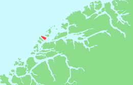 | |
 Flemsøya Location of the island | |
| Geography | |
|---|---|
| Location | Møre og Romsdal, Norway |
| Coordinates | 62°40′30″N 6°17′26″E / 62.6750°N 6.2906°ECoordinates: 62°40′30″N 6°17′26″E / 62.6750°N 6.2906°E |
| Area | 14.3 km2 (5.5 sq mi) |
| Length | 7 km (4.3 mi) |
| Width | 3 km (1.9 mi) |
| Highest elevation | 492 m (1614 ft) |
| Highest point | Skulen |
| Administration | |
Norway | |
| County | Møre og Romsdal |
| Municipality | Ålesund Municipality |
| Demographics | |
| Population | 503 (2015) |


Flemsøya or Skuløya is an island in Ålesund Municipality in Møre og Romsdal county, Norway. The 14.3-square-kilometre (5.5 sq mi) island is located between the islands of Haramsøya and Fjørtofta. The island is connected to the neighboring island of Haramsøya by the Ullasund Bridge. The population (2015) of the island was 503. The eastern and southern coastline is flat, the rest of the island is mountainous. The highest point, Skulen, is 492 metres (1,614 ft) tall. The village of Longva is located on the west side of the island, along the Longvafjorden.[1]
The new Nordøyvegen bridge and tunnel project will connect the island of Flemsøya to the mainland and its neighboring islands when it is completed in 2022.
See also[]
References[]
This Møre og Romsdal location article is a stub. You can help Wikipedia by . |
- Ålesund
- Islands of Møre og Romsdal
- Møre og Romsdal geography stubs