Florești, Prahova
Florești | |
|---|---|
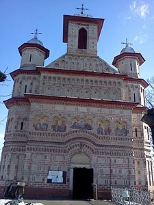 Dormition Church in Călinești | |
 Location in Prahova County | |
 Florești Location in Romania | |
| Coordinates: 45°2′N 25°48′E / 45.033°N 25.800°ECoordinates: 45°2′N 25°48′E / 45.033°N 25.800°E | |
| Country | Romania |
| County | Prahova |
| Government | |
| • Mayor (2020–2024) | Simona David (PNL) |
| Area | 29.63 km2 (11.44 sq mi) |
| Population (2011)[1] | 6,993 |
| • Density | 240/km2 (610/sq mi) |
| Time zone | EET/EEST (UTC+2/+3) |
| Vehicle reg. | PH |

Florești is a commune in Prahova County, Muntenia, Romania. It is composed of five villages: Cap Roșu, Călinești, Cătina, Florești, and Novăcești.
The commune is located in the western part of the county, on the banks of the Prahova River. The DN1 road passes just east of the commune; it connects Florești to the county seat, Ploiești (22 km (14 mi) to the southeast), and to Brașov (90 km (56 mi) to the north). On the western side of the commune is the Florești railway station, serving the Căile Ferate Române Line 300 that runs from Bucharest to Ploiești, Brașov, and on to the Hungarian border.
Its neighbors are Măgureni commune to the north, Filipeștii de Pădure commune to the west, the town of Băicoi to the east, and Ariceștii Rahtivani commune to the south.
References[]
- ^ "Populaţia stabilă pe judeţe, municipii, oraşe şi localităti componenete la RPL_2011" (in Romanian). National Institute of Statistics. Retrieved 4 February 2014.

| Authority control |
|
|---|
This Prahova County location article is a stub. You can help Wikipedia by . |
- Communes in Prahova County
- Localities in Muntenia
- Prahova County geography stubs