Fort St. Philip
Fort St. Philip | |
 Fort St. Philip in the U.S. Civil War | |
 | |
| Location | Plaquemines Parish, Louisiana, US |
|---|---|
| Nearest city | Triumph, Louisiana |
| Built | 1746 |
| NRHP reference No. | 66000380 |
| Significant dates | |
| Added to NRHP | October 15, 1966[1] |
| Designated NHL | December 19, 1960 |


Fort St. Philip is a historic masonry fort located on the eastern bank of the Mississippi River, about 40 miles (64 km) upriver from its mouth in Plaquemines Parish, Louisiana, just opposite Fort Jackson on the other side of the river. It formerly served as military protection of New Orleans, some 80 miles (130 km) up the river, and of the lower Mississippi River.
The first fort on this location, Fort San Felipe, was constructed in the 18th century during the period of Spanish control of Louisiana.
The fort served a role in protecting the United States from the British invasion during the War of 1812, seeing ten days of battle in January 1815, the 9th to the 18th, inclusive. Specifically, the fort held its defenses against British Navy vessels who were bombarding it, in a final attempt to invade Louisiana following the defeat of the British Army near New Orleans.[2]
The current fort was constructed, along with Fort Jackson, as a coastal defense for New Orleans and the Mississippi, upon the urging of Andrew Jackson. It was the site of a twelve-day siege in April 1862 by Union forces during the American Civil War, which was the decisive battle in the capture of New Orleans.
It was declared a National Historic Landmark in 1960.[3]
In the 1930s the fort was used as a tanning factory.[citation needed]
During the , Leander Perez threatened to jail opponents and demonstrators against segregation at the fort and in 1964 installed barbed wire.
From 1978 through 1989 the fort complex served as the site of an intentional, nonsectarian spiritual community called Vella-Ashby,[4][5] named by conjoining the surnames of the original and subsequent private property owners respectively. The community members numbered as many as 16 at any one time and were known as the Christos family. They lived in four buildings—three two-story officers quarters and an officers club—that remained from the re-fortification of the site during the 1898 Spanish–American War.[5]
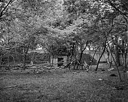
Fort St. Philip remains privately owned and in a state of bad deterioration. It was heavily damaged in 2005 during Hurricanes Katrina and Rita. According to the National Park Service, the owner reported that only the original brick fort and the concrete structures from the time of the Spanish–American War remain.
The site is accessible only by boat or helicopter, and following erosion of the small levee is now subject to flooding during high water levels of the Mississippi River.
See also[]
- National Register of Historic Places listings in Plaquemines Parish, Louisiana
- List of National Historic Landmarks in Louisiana
- Jackson Barracks, New Orleans
References[]
- ^ "National Register Information System". National Register of Historic Places. National Park Service. January 23, 2007.
- ^ Remini, Robert V. The Battle of New Orleans, 1999.
- ^ Patricia Heintzelman (1978). "National Register of Historic Places Inventory-Nomination: Fort St. Philip" (PDF). National Park Service. Cite journal requires
|journal=(help)32 KB and Accompanying 6 photos, aerial photos from 1935 and others, undated. (3.09 MB) <--The PDF is the only part of this reference which is still a working link, November 2015. - ^ Sutton, James (2007-09-10). "Ft. St. Philip -- Vella-Ashby". Panoramio. Retrieved 2008-11-08.
- ^ Jump up to: a b Raber, Rick (1984-02-26). "The Christos Experiment". The Times-Picayune, Dixie supplement. New Orleans.

External links[]
| Wikimedia Commons has media related to Fort St. Philip, Louisiana. |
- First Siege of Fort St. Philip (1815)—eyewitness accounts, as published in the Louisiana Historical Quarterly.
- Second Siege of Fort St. Philip (1862)—Chapter 15 of Kendall's History of New Orleans.
- Fort Saint Philip Budget Request at The Historic New Orleans Collection
| show Authority control |
|---|
Coordinates: 29°21′50″N 89°27′46″W / 29.36389°N 89.46278°W

- American Civil War forts
- Forts in Louisiana
- Louisiana in the American Civil War
- National Historic Landmarks in Louisiana
- Buildings and structures in Plaquemines Parish, Louisiana
- Ruins in the United States
- Spanish forts in the United States
- Colonial forts in Louisiana
- Forts on the National Register of Historic Places in Louisiana
- 1746 establishments in the French colonial empire
- National Register of Historic Places in Plaquemines Parish, Louisiana
- American Civil War on the National Register of Historic Places
- 1746 establishments in North America