Fort Tonoloway State Park
| Fort Tonoloway State Park | |
|---|---|
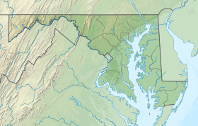 Location in Maryland | |
| Location | Washington County, Maryland, United States |
| Nearest town | Hancock, Maryland |
| Coordinates | 39°41′54″N 78°12′7″W / 39.69833°N 78.20194°WCoordinates: 39°41′54″N 78°12′7″W / 39.69833°N 78.20194°W |
| Area | 26 acres (11 ha)[2] |
| Designation | Maryland state park |
| Administrator | Maryland Department of Natural Resources |

Fort Tonoloway State Park is an undeveloped Maryland state park located near present-day Hancock. Fort Tonoloway was a frontier fort built in 1755 by Lt. Thomas Stoddert and men from the Maryland State Militia.[3] The fort was also known as Stoddert's Fort. It was abandoned in 1756 when Fort Frederick was constructed.[4][5]
The state park was at one time leased to the Boy Scouts. It is awaiting archaeological investigation before its use as a recreational facility can be assessed.[6]
References[]
- ^ "Fort Tonoloway State Park". Protected Planet. IUCN. Retrieved May 1, 2018.
- ^ "DNR Lands Acreage" (PDF). Maryland Department of Natural Resources. p. 8. Retrieved February 10, 2020.
- ^ "Fort Stoddert on the Tonoloways". C&O Canal Trust. Retrieved November 3, 2017.
- ^ "Tonoloway Fort". Maryland's Roadside Historical Markers. Maryland Historical Trust. Retrieved December 6, 2013.
- ^ Rubin, Mary H. (2003). The Chesapeake and Ohio Canal. Images of America. Arcadia Publishing. p. 96. ISBN 9780738515984.
- ^ "Maryland Land Preservation, Parks & Recreation Plan 2009" (PDF). Maryland Department of Natural Resources. p. 59. Retrieved December 6, 2013.
Further reading[]
- Tonoloway Fort: Outpost on the Maryland Frontier, Gerald Sword, Friends of Fort Frederick, 1994, ASIN: B002X49ZMA.
External links[]
- State Parks Maryland Manual On-Line
Categories:
- IUCN Category III
- State parks of Maryland
- Parks in Washington County, Maryland