Foum Zguid
Foum Zguid
فم زڭيد | |
|---|---|
Town | |
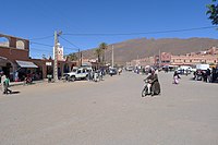 Foum Zguid City Center. | |
 Foum Zguid | |
| Coordinates: 30°05′07″N 6°52′25″W / 30.08528°N 6.87361°W | |
| Country | |
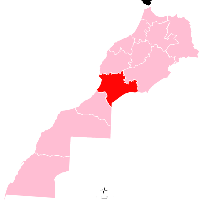
| Region | Souss-Massa |
| Province | Tata Province |
| Population (2004) | |
| • Total | 9,630 |
| Time zone | UTC+0 (WET) |
| • Summer (DST) | UTC+1 (WEST) |
| Postal code | 84150 |

Foum Zguid (Arabic: فم زڭيد, lit. 'mouth of the Zguid river') is a town in Tata Province, Souss-Massa, southeastern Morocco. According to the 2004 census it had a population of 9,630, the second-highest in the province after the capital Tata.[1]
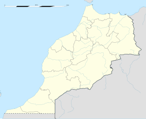
Foum Zguid is on the N12 highway to the northeast of Tata. Iriqui National Park is to the south of Foum Zguid, as is the border with Algeria, but no roads lead to either.
References[]
- ^ Maaroufi, Youssef. "Recensement général de la population et de l'habitat 2004".
External links[]
![]() Media related to Foum Zguid at Wikimedia Commons
Media related to Foum Zguid at Wikimedia Commons
Capital: Agadir | ||
| Provinces and prefectures |
|  |
| Cities | ||
Categories:
- Populated places in Tata Province
- Souss-Massa geography stubs