Fránquez, Morovis, Puerto Rico
Fránquez | |
|---|---|
Barrio | |
 Sign indicating improvements to recreational centers in Fránquez | |
 Location of Fránquez within the municipality of Morovis shown in red | |
 Fránquez Location of Puerto Rico | |
| Coordinates: 18°21′19″N 66°25′07″W / 18.355312°N 66.418477°WCoordinates: 18°21′19″N 66°25′07″W / 18.355312°N 66.418477°W[1] | |
| Commonwealth | |
| Municipality | |
| Area | |
| • Total | 4.2 sq mi (11 km2) |
| • Land | 4.2 sq mi (11 km2) |
| • Water | 0 sq mi (0 km2) |
| Elevation | 443 ft (135 m) |
| Population (2010) | |
| • Total | 4,583 |
| • Density | 1,091.2/sq mi (421.3/km2) |
| Source: 2010 Census | |
| Time zone | UTC−4 (AST) |
| Zip code | 00687 |

Fránquez is a barrio in the municipality of Morovis, Puerto Rico. Fránquez has twelve sectors and its population in 2010 was 4,583.[3][4][5]
History[]
Puerto Rico was ceded by Spain in the aftermath of the Spanish–American War under the terms of the Treaty of Paris of 1898 and became an unincorporated territory of the United States. In 1899, the United States Department of War conducted a census of Puerto Rico finding that the population of Fránquez barrio was 695.[6]
| Historical population | |||
|---|---|---|---|
| Census | Pop. | %± | |
| 1900 | 695 | — | |
| 1980 | 3,602 | — | |
| 1990 | 3,843 | 6.7% | |
| 2000 | 4,205 | 9.4% | |
| 2010 | 4,583 | 9.0% | |
| U.S. Decennial Census[7] 1899 (shown as 1900)[8] 1910-1930[9] 1930-1950[10] 1980-2000[11] 2010[12] | |||
Like all municipalities of Puerto Rico, Morovis was hit hard by Hurricane Maria on September 20, 2017. More than six months after Hurricane Irma, which had occurred just prior to Maria, the community's school still remained without power and an indignant population voiced their anger.[13]
Sectors[]
Barrios (which are roughly comparable to minor civil divisions)[14] in turn are further subdivided into smaller local populated place areas/units called sectores (sectors in English). The types of sectores may vary, from normally sector to urbanización to reparto to barriada to residencial, among others.[15][16][17]
The following sectors are in Fránquez barrio:[18]
Comunidad Fránquez, Sector Alianza, Sector Dávila, Sector Los Rosario, Sector Meléndez, Sector Narváez, Sector Pabón, Sector Pedro Meléndez Sánchez, Sector Rolón, Sector Rosado, Sector Socucho, and Urbanización La Alianza.
Gallery[]
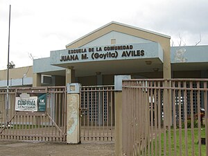
Juana M. (Goyita) Avilés, a school in Franquez

See also[]
References[]
- ^ a b "US Gazetteer 2019". US Census. US Government.
- ^ U.S. Geological Survey Geographic Names Information System: Fránquez barrio
- ^ Picó, Rafael; Buitrago de Santiago, Zayda; Berrios, Hector H. Nueva geografía de Puerto Rico: física, económica, y social, por Rafael Picó. Con la colaboración de Zayda Buitrago de Santiago y Héctor H. Berrios. San Juan Editorial Universitaria, Universidad de Puerto Rico,1969. Archived from the original on 2018-12-26. Retrieved 2019-01-15.
- ^ Gwillim Law (20 May 2015). Administrative Subdivisions of Countries: A Comprehensive World Reference, 1900 through 1998. McFarland. p. 300. ISBN 978-1-4766-0447-3. Retrieved 25 December 2018.
- ^ Puerto Rico:2010:population and housing unit counts.pdf (PDF). U.S. Dept. of Commerce, Economics and Statistics Administration, U.S. Census Bureau. 2010. Archived (PDF) from the original on 2017-02-20. Retrieved 2019-01-15.
- ^ Joseph Prentiss Sanger; Henry Gannett; Walter Francis Willcox (1900). Informe sobre el censo de Puerto Rico, 1899, United States. War Dept. Porto Rico Census Office (in Spanish). Imprenta del gobierno. p. 161. Archived from the original on 2012-11-15. Retrieved 2020-03-24.
- ^ "U.S. Decennial Census". United States Census Bureau. Archived from the original on February 13, 2020. Retrieved September 21, 2017.
- ^ "Report of the Census of Porto Rico 1899". War Department Office Director Census of Porto Rico. Archived from the original on July 16, 2017. Retrieved September 21, 2017.
- ^ "Table 3-Population of Municipalities: 1930 1920 and 1910" (PDF). United States Census Bureau. Archived (PDF) from the original on August 17, 2017. Retrieved September 21, 2017.
- ^ "Table 4-Area and Population of Municipalities Urban and Rural: 1930 to 1950" (PDF). United States Census Bureau. Archived (PDF) from the original on August 30, 2015. Retrieved September 21, 2014.
- ^ "Table 2 Population and Housing Units: 1960 to 2000" (PDF). United States Census Bureau. Archived (PDF) from the original on July 24, 2017. Retrieved September 21, 2017.
- ^ Puerto Rico:2010:population and housing unit counts.pdf (PDF). U.S. Dept. of Commerce Economics and Statistics Administration U.S. Census Bureau. 2010. Archived (PDF) from the original on 2017-02-20. Retrieved 2019-08-02.
- ^ "Escuela en Morovis lleva 200 días sin energía [School in Morovis has been without power for 200 days]". wapa tv (in Spanish). Archived from the original on 2019-05-31. Retrieved 2019-05-31.
- ^ "US Census Barrio-Pueblo definition". factfinder.com. US Census. Archived from the original on 13 May 2017. Retrieved 5 January 2019.
- ^ "Agencia: Oficina del Coordinador General para el Financiamiento Socioeconómico y la Autogestión (Proposed 2016 Budget)". Puerto Rico Budgets (in Spanish). Archived from the original on 28 June 2019. Retrieved 28 June 2019.
- ^ Rivera Quintero, Marcia (2014), El vuelo de la esperanza: Proyecto de las Comunidades Especiales Puerto Rico, 1997-2004 (first ed.), San Juan, Puerto Rico Fundación Sila M. Calderón, ISBN 978-0-9820806-1-0
- ^ "Leyes del 2001". Lex Juris Puerto Rico (in Spanish). Archived from the original on 14 September 2018. Retrieved 24 June 2020.
- ^ "PRECINTO ELECTORAL MOROVIS 020" (PDF). Comisión Estatal de Elecciones (in Spanish). PR Government. 8 October 2019. Retrieved 24 June 2020.
This Morovis, Puerto Rico location article is a stub. You can help Wikipedia by . |
- Barrios of Morovis, Puerto Rico
- Puerto Rico Senatorial district III geography stubs